
UPDATES CONTINUE AT THE FOLLOWING POST: UPDATED ALERT FOR POSSIBLE EAST COAST TSUNAMI CONT’D 5
I HAD TO OPEN ANOTHER NEW POST. THIS ONE WAS GETTING TOO LARGE TO HANDLE. BUT THE SITUATION CONTINUES. I WILL CONTINUE TO UPDATE YOU DAILY. FOLLOW THE LINKS!
UPDATE: 11/08/2021; 5:26:29 AM– STAY ALERT – Confirmed there were two Earthquakes over 4.0 yesterday at 5:07 pm.
Another ShockWave caught on film.
Winds are spreading the Ash, Air Quality Worsens/ Dangerous to breath
Confirmation of the 4.8 Magnitude Earthquake earlier today. (Folks, a 4.8 is not far from a 5.0 so be ready, they are coming!)
It seems like the experts all want us to think this is coming to a close. See the update below.
Another 4.8 this one down graded to a 4.5 occurred Sun, Nov 7 @ 5:07 PM
Alive, Awake and Rising!
A Trip to Hell in Houston.
4.8 Earthquake downgraded to a 4.3 8:40 pm Sat Nov 6
The Volcano is displaying some very violent behavior and putting on some very amazing spectacles.
– RED ALERT!! – Lots of activity. Increase in deflation, emission of gases, seismic activity. Magma building up. It is quite apparent there ARE now two Volcanos active not matter what the “Officials” say. See updates below.
It is OFFICIAL, Only One Cone/Volcano with several vents.
4.0 Earthquake; 1:39 AM
EVER CHANGING SITUATION. New developments in the make up of the volcano. Possibly there may be one or even two more volcano cones.
Ok, Folks, this could be crucial not only for those living in the Eastern portion of our Nation, but for all of us. If this thing occurs the way they are predicting, it will devastate our entire nation. Millions of lives will be lost. The rest of us will be affected you can count on it.
If and/when I receive any updates I will add them to this post or create a new one and link it.
I do want to tell you that I had receive notification that the La Palma Alert had been updated to ORANGE or LEVEL However, the postings related to that have been removed from all outlets. I don’t know why or what that means. I will continue to search for updates and documentation of the Alert Status. Which I will post here.
Be PREPARED not Scared!! Have FAITH IN GOD. Keep Looking UP!! OUR REDEMPTION DRAWETH NIGH!
Ok, Folks, this could be crucial not only for those living in the Eastern portion of our Nation, but for all of us. If this thing occurs the way they are predicting, it will devastate our entire nation. Millions of lives will be lost. The rest of us will be affected you can count on it.
If and/when I receive any updates I will add them to this post or create a new one and link it.
Be PREPARED not Scared!! Have FAITH IN GOD. Keep Looking UP!! OUR REDEMPTION DRAWETH NIGH!
Here are the links for all the parts of this coverage of the La Palma Event:
Millions Could Be Washed Away (original post)
-
Cumbre Viejo Volcano Could Mean Disaster for the US EAST COAST
-
UPDATED ALERT FOR POSSIBLE EAST COAST TSUNAMI
-
UPDATED ALERT FOR POSSIBLE EAST COAST TSUNAMI CONTINUED
-
UPDATED ALERT FOR POSSIBLE EAST COAST TSUNAMI CONT’D 2
-
UPDATED ALERT FOR POSSIBLE EAST COAST TSUNAMI CONT’D 3
-
UPDATED ALERT FOR POSSIBLE EAST COAST TSUNAMI CONT’D 4
-
UPDATED ALERT FOR POSSIBLE EAST COAST TSUNAMI CONT’D 5
-
UPDATED ALERT FOR POSSIBLE EAST COAST TSUNAMI CONT’D 6
-
UPDATED ALERT FOR POSSIBLE EAST COAST TSUNAMI CONT’D 7
RESCOURCES FOR INFORMATION ON THE CURRENT SITUATION:
LIVE CAMERAS:
![]() https://kimedia.es/es/play/
https://kimedia.es/es/play/
spacer
 TelevisionCanaria
DIRECTO | Erupción del volcán en La Palmaspacer
spacer
 TV La Palma
https://www.youtube.com/channel/UCY8cRUQNNGbEczTAA2NXhYw/videos
spacer


https://twitter.com/LetUsUniteHere/
good place to sign up for updates
 #erupcionlapalmaa3n
spacer
 INVOLCAN
 Geological and Mining Institute of Spain
Flood Map.netmap out where the water will go in your area.
spacer
 OffGridDesertFarmingwithPaul&Adrienne
Paul & Adrienne on Oddessey:
https://odysee.com/@OffGridDesertFarmingwithPaulandAdrienne:9
Off Grid Desert Farming with Paul & Adrienne 2
Paul & Adrienne Back Up Youtube Channel
https://www.youtube.com/channel/UCAe9AAO-okgtAMeq7Qz-svA
*Secondary Channel* ‘In2thinairNEWS’ https://www.youtube.com/c/in2thinairnews *SEND your videos and pictures in to be featured in future videos!* TWITTER @In2ThinAir
spacer

Bushcraft Bear
Link: https://www.youtube.com/channel/UCZB7zNCIi3F6uWCJZa-qdVQ
spacer
NYPrepper
https://www.youtube.com/channel/UCz-qVkgMHSvLVyMgqRgEwYQ
spacer
https://www.youtube.com/channel/UCSt18BczGacALyaPN_VYPWw
spacer
GutnTog(Has left the Island)
https://www.youtube.com/user/MrRomko1
spacer
sCANARY ISLANDS EARTHQUAKE LINKS:

Visualizador terremodos Canarios
spacer
Live Ocean Feed: https://www.youtube.com/watch?v=Q-pHS4i4ScE

spacer
The Official EMSC Earthquake Apps
spacer
 Link: https://www.volcanodiscovery.com
Please keep the people of La Palma in your prayers and on your mind. No matter whether or not the volcano causes a Mega Tsunami, these people have been devastate. Their lives will NEVER be the same. It will take years to regain what has been lost. PLEASE, if you are able, send donations. DO NOT SEND THEM TO THE RED CROSS or THE GOVERNMENT. CORRUPTIONS IS RAMPANT. FIND a group of local people who are helping people in their local areas. It will take some digging to find them. BUT GOD WILL BLESS YOU! Remember that this has already been going on for a long time and it is no where near over yet. FUNDS AND SUPPLIES RUN OUT FAST. When there is nothing to share, there is no way to extend aid and assistance. PLEASE DON’T FORGET THEM. HELP THEM IF YOU CAN!
Here are some places you can start. Find a group that you trust. Better yet, ASK GOD to lead you to those who need the help, and those who will be sure to get it to them. BE SAFE, BE WELL AND BE BLESSED. KEEP WATCHING AND KEEP LOOKING UP!
WHERE TO SEND DONATIONS:
I am not vouching for the honesty and integrity of the following, they are the only places I could find online, where you can send donations. Pray before you send them that GOD will be in control of getting them to those in need.
PEOPLE HELPING PEOPLE FUNDING ACCOUNTS:
El Paso, La Palma, Canary Islands / Emergencies
We are working with SAMU, a local photographer who has been documenting the eruption each night from a friend’s rooftop with a telescopic lens. He himself has been evacuated as his own house is so close to the lava and in danger of being swallowed at any moment.
We offered to pay SAMU for using his photos, but he didn’t want any money for himself – rather he asked us to raise money directly to help other local families around him that have lost everything in the volcanic emergency.
We are grateful for all donations, large or small. £5 could buy a volcano safety kit including goggles, FFP2 face mask and hand sanitiser. Larger donations will help towards replacing items families have lost in the emergency. Donations and acquisitions will be itemised, documented and published for full transparency.
Using the hashtag #SamuLaPalma we will be publishing a photo of his every day on Instagram (@GeoTenerife) until the end of the month, and asking anyone wanting to support La Palma to make a donation to this JustGiving account.
We will travel to La Palma at the end of the month and present Samu with the proceeds, and follow up on specifically how they are used via our social media channels (Twitter and Instagram: GeoTenerife).spacer
La Palma, Canary Islands, Spain Emergencies
Where will the funds go?
The funds collected will go to the official account of the city council of El Paso, which is the village where the volcano eruption is taking place. They are currently in charge of handling the funds to help the victims of the volcano.
Being abroad, we are aware that a bank transfer is not always the easiest way to donate. Wherever you are in the world, this platform offers the possibility to donate easily as an online payment. If you prefer, you can always donate to the official accounts directly. What’s important is that the funds get there.
If you want to know more about me, or would like to feel more confident about the legitimacy of this campaign, you can visit my LinkedIn profile.
THANKS for your help!!
OFFICIAL AID CONTACT INFORMATION:

The municipalities of El Paso and Los Llanos de Aridane have requested donations of money through various accounts, as has the Cabildo de La Palma, which has enabled Bizum payments.
In the specific case of El Paso, in addition to donations, the local town hallare asking for volunteers to attend the emergency and accommodation for the evacuees.
EL PASO CONTACT INFO
Want to contact the Administration of El Paso? Here are all the details of El Paso available below.
| El Paso Postal address | Avenida de Jose Antonio, 18 38750 EL PASO España |
|---|---|
| El Paso Phone | 922 48 51 30 International: +34 922 48 51 30 |
| El Paso #DE_EDIFICE# fax number | 922 48 59 78 International: +34 922 48 59 78 |
| El Paso Email address | cgonzalez@ayuntamientodeelpaso.org |
The Yaiza City Council, in Lanzarote,is organising a collection, unable to find info
UGT Canarias, both in Tenerife and on Gran Canaria.
| LA PALMA (Santa Cruz) | Constitution Square, 4 | uilapalma@canarias.ugt.org |
| GRAN CANARIA (Las Palmas) | Avda. 1º de Mayo, 21 – 1ª | uigcanaria@canarias.ugt.org / ugt@canarias.ugt.org |
| TENERIFE (Santa Cruz de) | C / Méndez Núñez, 84 | uitenerife@canarias.ugt.org |
Help from Southern Gran Canaria
FACEBOOK ACCOUNTS:
WeAreWarriors.shop, the multi-focused charity shop and community hub in Puerto Rico de Gran Canaria, have started to organise donations and collections to send
![]()
https://www.facebook.com/WeAreWarriors.Shop/ We Are Warriors Shop is at We Are Warriors Shop.
Karuna Association in Maspalomas who are organising a collection to gather clothes, food and other items to send to La Palma.

 Asociación Karuna Maspalomas
10, 2020 ·
SPACU
UPDATE: 11/08/2021; 5:22:47 PM
spacer
UPDATE: 11/07/2021; 9:23:52 PM
spacer
One of the explosions in the volcano and you can see its shock wave, it has a lot of force, it was seen just at the end of the news program on TV Canaria. #ErupcionLaPalma #VolcanLaPalma #VolcandeLaPalma #Eruptin #VolcanLaPalma
Volcano Shockwave Caught at Night!!!

Via @CSierraSP https://t.co/8tdfusFJAL pic.twitter.com/sKTAwIXCN7—
𝓻𝓪𝓬𝓵𝓮 (@LetUsUniteHere) November 8, 2021
spacer
UPDATE: 11/07/2021;6:42:57 PM
spacer
Nov 7, 2021
spacer
Puerto Naos#FuerzaLaPalma
Fuente :MediaRook#ElVolcanDeLaPalma#LaPalma#LaPalmaEruption#CumbreVieja#Volcano#ErupcionLaPalma pic.twitter.com/tfFU13pCpy— Life (@JavierApophis) November 7, 2021
spacer
 @LetUsUniteHere
|
spacer
spacer
CONFIRMATION OF THE 4.8 Earthquake today.
spacer
UPDATE: 11/07/2021; 2:51:47 PM
spacer
Nov 7, 2021


 Since the last statement, 42 earthquakes have been located in the area affected by the volcanic reactivation of Cumbre Vieja, 6 of these earthquakes have been felt by the population, having reached the maximum intensity in the epicentral zone of IV (EMS98).
  The largest earthquake was the one that occurred at 20:40(UTC) yesterday, with magnitude 4.5 mb Lg at 36 km depth and direction with intensity IV on the island of La Palma. In the period considered, 1 earthquake has been located at a depth of around 30 km, the rest of the hypocenters of the period are located at a shallower depth, around 12 km.
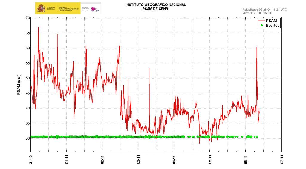
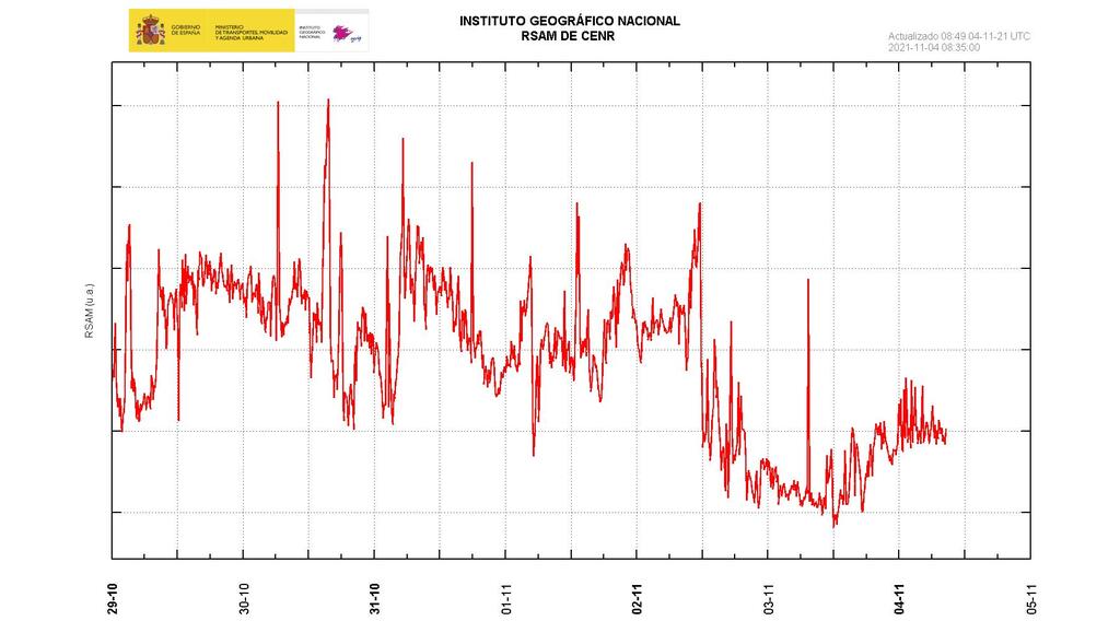
  The amplitude of the volcanic tremor signal has medium high levels, with intensification pulses.
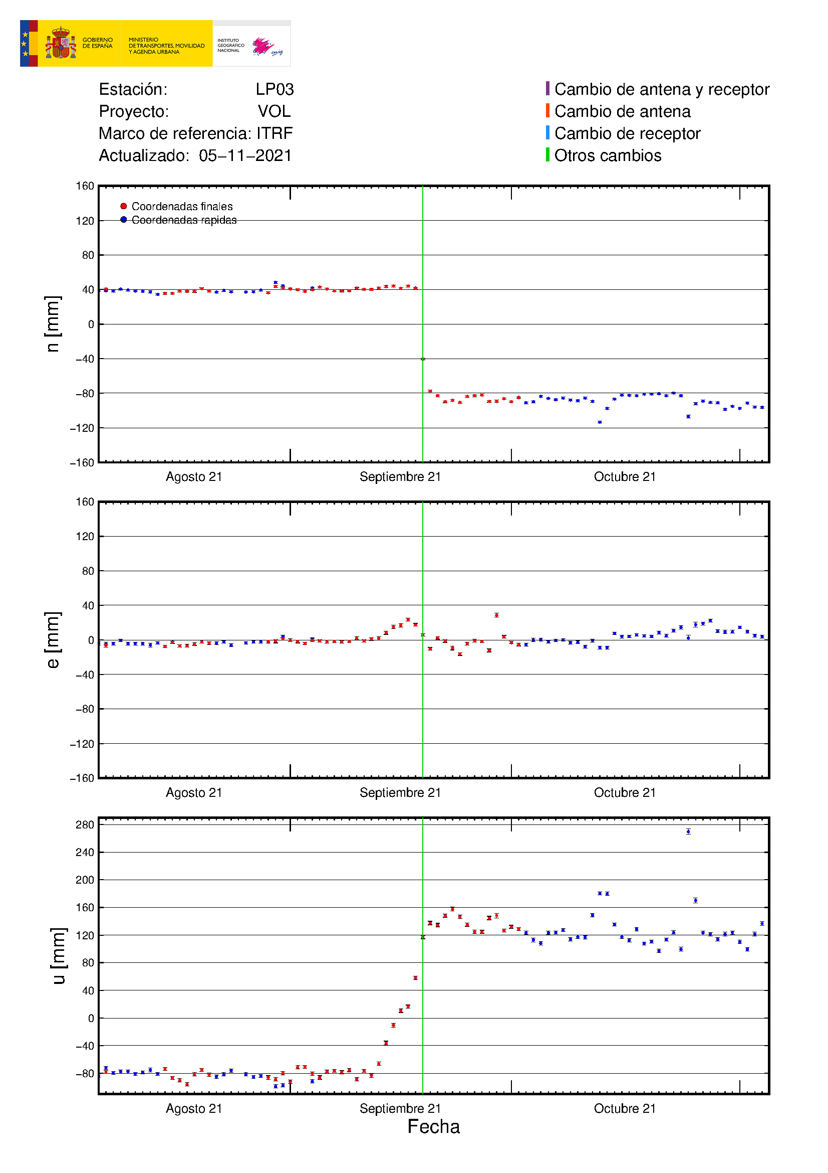
  The island’s network of permanent GNSS stations shows that the elevation recorded on days 4 and 5 at station LP03, which is the closest to the eruptive centers, has completely reversed. However, the southwestern deformation recorded by the station is still ongoing.
  A slight deflation is maintained in the rest of the stations, possibly related to deep seismicity.
  In view of the calibrated image,08:45UTC a column height of 2,700 m. with a west-southwest direction. Yesterday the thermal and visual camera was moved from the north flank to the east of the volcano to continue with the continuous acquisition of images in both spectra. The IGN continues its presence on the island, where the CAVE (Center of Attention and Eruption Surveillance).

 The National Geographic Institute (IGN) has detected a total of 18 earthquakes on La Palma this Sunday, among them, three were felt by the population, although they did not exceed magnitude 3.4.
  Two of the three felt earthquakes, of 3.4 and 3.3 occurred in Fuencaliente and the other, of 3.2 in Mazo and all three were registered at dawn and at depths of between 13 and 14 kilometers
  Air quality It is especially unfavorable in the municipalities near the volcano -El Paso, Fuencaliente, Tijarafe and Los Llanos de Aridane-.
  In this regard, 112 Canarias has recommended to risk population groups to avoid prolonged stay outdoors and to follow the medical treatment plan that they are following meticulously, as well as to go to an emergency service if their health condition worsens . The roof and roof cleaning work that is being carried out in the affected areas continues and in the works that will be carried out in the next few days to remove ash and pyroclasts with heavy machinery to facilitate access to homes that have accumulations important in their surroundings and ceilings. The National Geographic Institute (IGN) has located about 19 earthquakes on La Palma, the largest being the one registered at 02:06 this Sunday when it reached 3, (since this report there has been a 4.8 which was reduced to a 4.5)
spacer
WOW, I JUST NOTICED THIS LITTLE NOTE AT THE BOTTOM OF THE LIST FROM CSEM/EMSC. Have you seen this?? So, the EMSC rates their Magnitudes a whole level beneath the rest of Europe. So their 4.8 is a 5.8?? The EMSC magnitude rating for the resent Earthquake at La Palma is 4.5 the same as VolcanoDiscovery/IGN. Does that mean it was a 5.5?? Or as originally reported 5.8 instead of 4.8?
Bold : Earthquakes with a magnitude ≥ 4.5 in Euro-med, or ≥ 5.5 in the world
Red : Earthquakes with a magnitude ≥ 5 in Euro-med, or ≥ 6 in the world


CANARY ISLANDS / Nov 7, 2021
Results found : 50 SO FAR TODAY! Looks like the Earthquake activity is rising.
| CANARY ISLANDS / Nov 6, 2021
Results found : 33 CANARY ISLANDS / Nov 5, 2021 Results found : 34 CANARY ISLANDS / Nov 4, 2021 Results found : 82 CANARY ISLANDS / Nov 3, 2021 Results found : 114 |
CANARY ISLANDS / Nov 2, 2021
Results found : 116 CANARY ISLANDS / Nov 1, 2021 Results found : 172 CANARY ISLANDS / Oct 31, 2021 Results found : 95 CANARY ISLANDS / Oct 30, 2021 Results found : 99 |
It appears they have been made aware of their error (putting the 11/5 data on the 11/7 report) and have corrected it. Here is the new report they have posted.
20:01 PM | BY: T
Sun, 7 Nov 2021, 20:01
La Palma, Canary Islands: eruption Sep 2021 – updates
Updated: Nov 7, 2021 20:39 GMT – 9 minutes ago
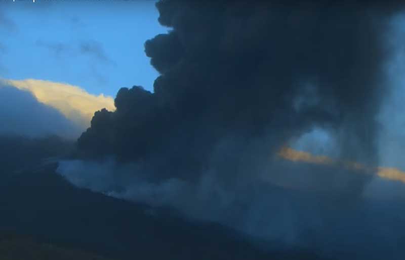
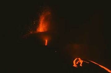
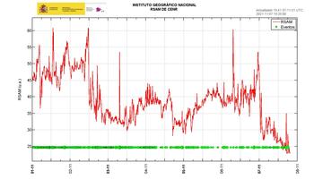
The activity at the volcano continues at levels similar to yesterday, reduced compared to the weeks before.
Visually, intermittent, pulsating weak lava fountains could be observed in the early morning hours from the main vent at the cone along with the effusion of several smaller lava flows on the western slopes of the cone. The explosions at the summit vent continued to produce ash plumes reaching up to 8,000 ft / 2.4 km altitude drifting SW over the ocean.
Volcanic tremor has been following a decreasing trend, which suggests that the magma rate is decreasing as well. No significant change occurred at the lava fronts of the lava flow field, which is now 983,4 hectares large and has destroyed or damaged at least 2,714 buildings.
Ground deformation returned to values similar to 48 hours ago, which likely mean that yesterday’s peak of inflation at the LP03 station was likely caused by an instrumental error. Overall, it also follows a trend of decrease or deflation.
Seismic activity has also been reduced compared to the previous weeks, with only 55 quakes during 24 hours with magnitudes above 2.2. The largest was a deep (38 km) magnitude 4.5 tremor at 5.07 p.m. this afternoon, which was widely felt on the island.
- All news about: La Palma volcano
- Information about: La Palma volcano
spacer
UPDATE: 11/07/2021; 12:47:22 PM
spacer
Nov 7, 2021
spacer
Imágenes de hoy a las 16.00 (hora canaria) desde los alrededores del Mirador Astronómico del Llano del Jable / Today's images at 4:00 p.m. (Canarian time) from the surroundings of the Llano del Jable Astronomical Viewpoint. Créditos: Sabrina Mugnos. pic.twitter.com/1cDjS4pNZD
— INVOLCAN (@involcan) November 7, 2021
spacer
|
There were two next to one another? Hmm..
Quote Tweet
@LetUsUniteHere
·
4.8 quake, 37 km..variations on this, 17 minutes ago. #LaPalma
Show this thread
|
spacer
spacer
![]()
Moderate mag. 4.6 earthquake – La Palma Island, 14 km southeast of Los Llanos de Aridane, Spain, on Sunday, Nov 7, 2021 5:07 pm (GMT +0) – 1 hour 22 minutes ago
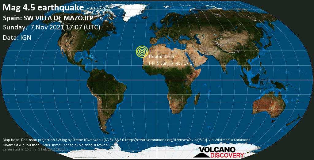
Moderate magnitude 4.6 earthquake at 37 km depth
7 Nov 17:11: Now using data updates from IGN
7 Nov 17:28: Magnitude recalculated from 4.8 to 4.6. Hypocenter depth recalculated from 25.0 to 37.0 km (from 15.5 to 23 mi). Epicenter location corrected by 20 km (13 mi) towards N.
Moderate 4.8 quake hits near Los Llanos de Aridane, La Palma Island, Canary Islands, Spain
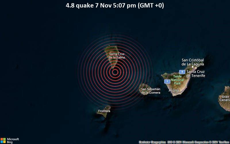
The quake hit at a shallow depth of 25 km beneath the epicenter near Los Llanos de Aridane, La Palma Island, Canary Islands, Spain, in the afternoon on Sunday, November 7th, 2021, at 5:07 pm local time. The exact magnitude, epicenter, and depth of the quake might be revised within the next few hours or minutes as seismologists review data and refine their calculations, or as other agencies issue their report.
A second report was later issued by the European-Mediterranean Seismological Centre (EMSC), which listed it as a magnitude 4.8 earthquake as well.
Based on the preliminary seismic data, the quake was probably felt by many people in the area of the epicenter. It should not have caused significant damage, other than objects falling from shelves, broken windows, etc.
In Fuencaliente de la Palma (pop. 1,900) located 11 km from the epicenter, the quake should have been felt as light shaking.
Weak shaking might have been felt in Mazo (pop. 4,800) located 23 km from the epicenter, Breña Baja (pop. 4,200) 25 km away, Brena Alta (pop. 7,100) 27 km away, El Paso (pop. 7,100) 28 km away, Tazacorte (pop. 5,700) 29 km away, Los Llanos de Aridane (pop. 20,800) 30 km away, and Santa Cruz de La Palma (pop. 17,100) 31 km away.
VolcanoDiscovery will automatically update magnitude and depth if these change and follow up if other significant news about the quake become available. If you’re in the area, please send us your experience through our reporting mechanism, either online or via our mobile app. This will help us provide more first-hand updates to anyone around the globe who wants to know more about this quake.
La Palma, Canary Islands: eruption Sep 2021 – updates
Activity slows down while ground deformation and gas emissions pick up
Update Fri 05 Nov 2021 17:26 ??? WHY IS All THIS INFORMATION IS OLD! LOOK AT THE DATES!
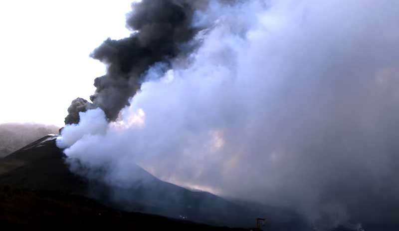
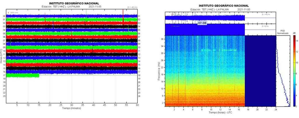
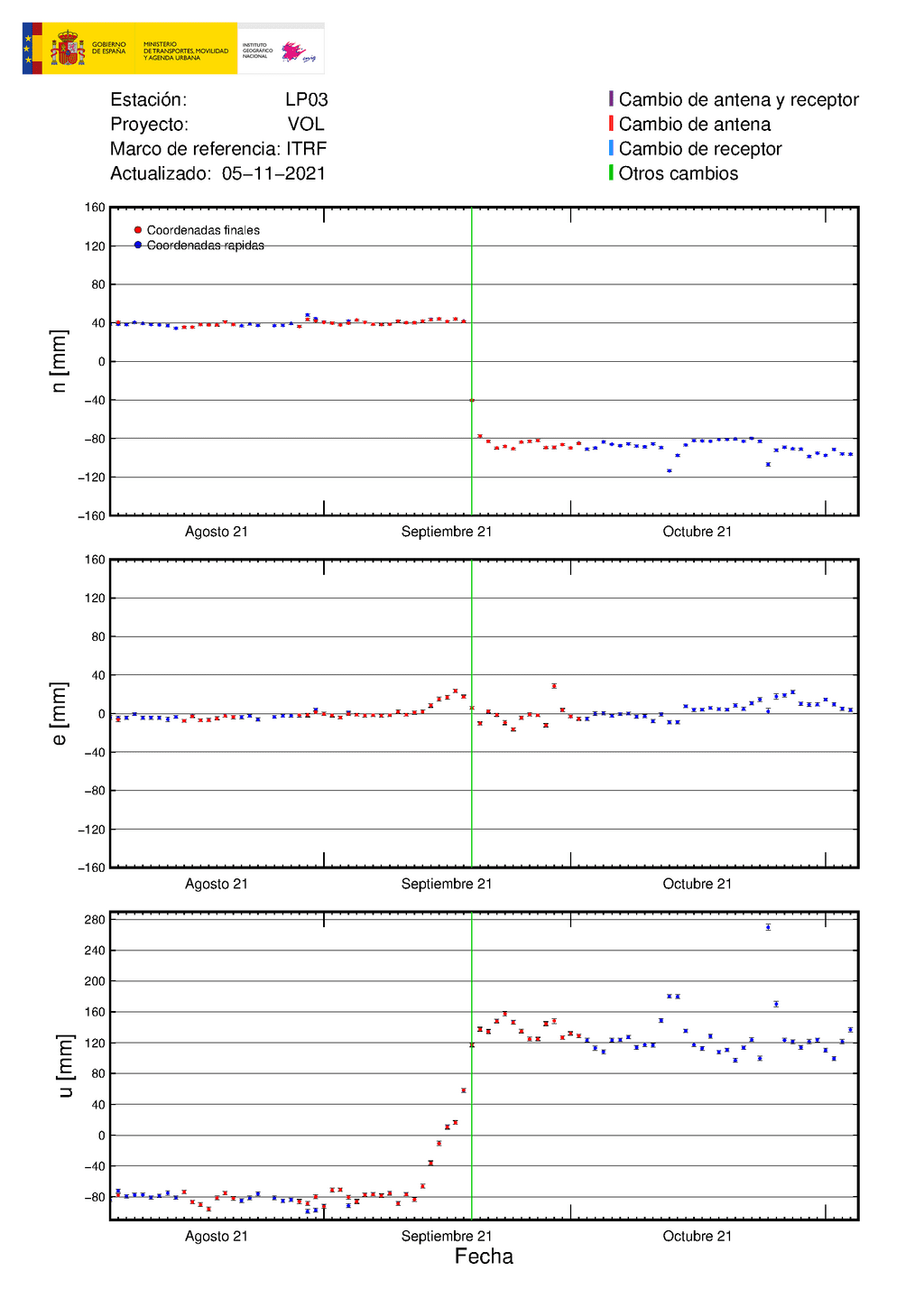
Both the visible eruptive activity at the vent and the lava flows as well as internal seismic activity have been lower today overall. Ash emissions are more intermittent and less intense since the marked drop in volcanic tremor yesterday.
This morning, the ash plume reached 8,000 ft (2.4 km) altitude, but it has no longer been continuous. The lava flows remain active. So far, they have covered an area of nearly 10 square kilometers and destroyed 2581 houses according to official sources.
While this might look as if the peak of the eruption is over and it might be in a phase of dying down slowly, tremor remains significant, and even has been increasing again in the past 6 hours. In addition, ground deformation has again been showing a trend of uplift, now totaling approx. 13-14 cm, suggesting that more magma is being stored at depth than what is being erupted.
Sulfur dioxide (SO2) and carbon dioxide (CO2) emissions have risen also, to 29,000 tons per day and 1,850 tons per day, respectively. This increase fits with the model of more magma arriving at depth.
Nov 7, 2021
spacer
UPDATE: 11/07/2021; 6:37:49 AM
spacer
Imágenes de las 10.15 (hora canaria) desde Tacande / Images at 10.15 am (Canarian time) from Tacande pic.twitter.com/4QCAKvFq5q
— INVOLCAN (@involcan) November 7, 2021
spacer
spacer
Nov 7, 2021
Nov 6, 2021
spacer
UPDATE: 11/07/2021; 2:32:11 AM
SPACER
Travis Scott’s UTOPIA MOUNTAIN created a Living Hell for many of his fans Last night.
You gotta wonder why in the world was that set built to so elaborately create the imagery of a volcanic eruption?
And why the imagery of the Phoenix Rising up out of the flames?? It is all part of their Magick spell casting. The Great Work, bringing their dasterdly plans into fruition. It is very much like the “Rain Dance” or the “Buffalo Dance” or the “Bear Dance”. The Magical Mystical Dark Demonic War Dance of the Illumined.
 |
 |
When you watch the video you can really appreciate the nuances and movement of the images. They create the hypnotic affect and the amazing spectacle viewed by those who watch the La Palma Volcano as it goes through it various phases.
 |
 |
 |
 |
 |
 |
 |
 |
 |
 |
 |
 |
 |
 |
 |
 |
 |
 |
SPACER
Astroworld Festival – latest: Travis Scott ‘devastated’ by crowd surge that killed eight at Houston concert
ByThomas Kingsley and Io Dodds
NOV 6, 2021 News

Nov 6, 2021
“And the angel took the censer, and filled it with fire of the altar, and cast it into the earth: and there were voices, and thunderings, and lightnings, and an earthquake.” ~ Revelation 8:5
spacer
Impresionante actividad estromboliana la que muestra esta noche la erupción a las 19.30 (hora canaria) desde Tacande / Impressive strombolian activity shown tonight by the eruption at 19:30 (Canarian time) from Tacande #ErupcionLaPalma #LaPalmaEruption #LaPalma pic.twitter.com/rFjuKEyC3a
— INVOLCAN (@involcan) November 6, 2021
spacer
UPDATE: 11/06/2021: 7:36:10 PM
spacer
![]()
| Nov 6, 2021 8:40 pm (GMT +0) (Nov 6, 2021 20:40 GMT) 3 hours 21 minutes ago |
4.3
33 km |
La Palma Island, 16 km southeast of Los Llanos de Aridane, Spain I FELT IT – 33 reports |
spacer
JUST LOOK AT ALL THE NUMBERS IN THIS ARTICLE. ALL OF THEM VERY SIGNIFICANT TO THE ELITE!! It would take me a long time to decipher all those. But, someone who is familiar with numberology can spot them in a minute.
Light mag. 4.3 earthquake – La Palma Island, 16 km southeast of Los Llanos de Aridane, Spain, on Saturday, Nov 6, 2021 8:40 pm (GMT +0) – 3 hours 33 minutes ago
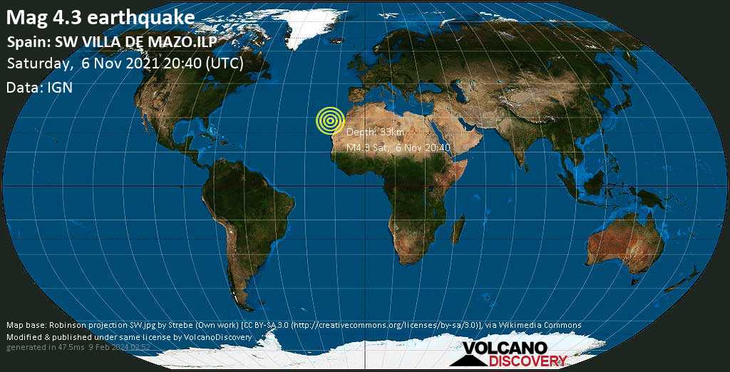
Light magnitude 4.3 earthquake at 33 km depth
6 Nov 20:48: Magnitude recalculated from 4.7 to 4.3. Hypocenter depth recalculated from 37.0 to 30.0 km (from 23 to 18.6 mi). Epicenter location corrected by 3.1 km (1.9 mi) towards SSW.
… [show all] …
6 Nov 20:54: Magnitude recalculated from 4.5 to 4.3. Hypocenter depth recalculated from 36.0 to 33.0 km (from 22 to 21 mi). Epicenter location corrected by 3 km (1.9 mi) towards E.
Moderate magnitude 4.7 earthquake 17 km southeast of Los Llanos de Aridane, Spain
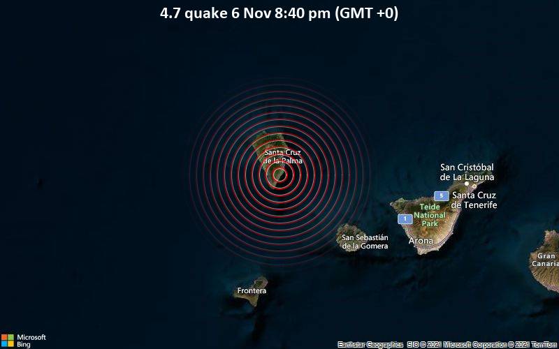
The event was filed by Spain’s Instituto Geográfico Nacional (IGN), the first seismological agency to report it.
A second report was later issued by the European-Mediterranean Seismological Centre (EMSC), which listed it as a magnitude 4.6 earthquake.
Based on the preliminary seismic data, the quake should not have caused any significant damage, but was probably felt by many people as light vibration in the area of the epicenter.
Weak shaking might have been felt in Mazo (pop. 4,800) located 6 km from the epicenter, Breña Baja (pop. 4,200) 8 km away, Brena Alta (pop. 7,100) 11 km away, El Paso (pop. 7,100) 14 km away, Santa Cruz de La Palma (pop. 17,100) 14 km away, Los Llanos de Aridane (pop. 20,800) 17 km away, Tazacorte (pop. 5,700) 17 km away, and Garachico (pop. 6,000) 25 km away.
VolcanoDiscovery will automatically update magnitude and depth if these change and follow up if other significant news about the quake become available. If you’re in the area, please send us your experience through our reporting mechanism, either online or via our mobile app. This will help us provide more first-hand updates to anyone around the globe who wants to know more about this quake.
Earthquake data
Date & time: Nov 6, 2021 20:40:24 UTC – 3 hours 33 minutes ago
Local time at epicenter: Saturday, Nov 6, 2021 8:40 pm (GMT +0)
Magnitude: 4.3
Depth: 33.0 km
Epicenter latitude / longitude: 28.5451°N / 17.8143°W
![]() (Tenerife, Canary Islands, Spain)
(Tenerife, Canary Islands, Spain)
Antipode: 28.545°S / 162.186°E
Nearest volcano: La Palma (5 km / 3 mi)
Nearby towns and cities:
7 km (4 mi) NNE of Fuencaliente de la Palma (La Palma Island) (pop: 1,890) –> See nearby quakes!
16 km (10 mi) SSW of Santa Cruz de La Palma (La Palma Island) (pop: 17,100) –> See nearby quakes!
16 km (10 mi) SE of Los Llanos de Aridane (La Palma Island) (pop: 20,800) –> See nearby quakes!
26 km (16 mi) S of Garachico (Santa Cruz de Tenerife, Kanarische Inseln) (pop: 6,000) –> See nearby quakes!
32 km (20 mi) SSE of Santo Domingo (pop: 1,930) –> See nearby quakes!
67 km (42 mi) NW of Vallehermoso (pop: 3,300) –> See nearby quakes!
85 km (53 mi) NW of San Sebastian de La Gomera (Santa Cruz de Tenerife) (pop: 8,960) –> See nearby quakes!
122 km (76 mi) WNW of Arona (pop: 78,600) –> See nearby quakes!
153 km (95 mi) W of Tenerife (pop: 222,400) –> See nearby quakes!
240 km (149 mi) WNW of Las Palmas de Gran Canaria (pop: 381,800) –> See nearby quakes!
Broken Clouds
 17.3°C (63 F), humidity: 60%, wind: 6 m/s (12 kts) from N
Primary data source: IGN (Instituto Geográfico Nacional)
Estimated released energy: 1.8 x 10¹¹ joules (49.4 megawatt hours, equivalent to 42.5 tons of TNT) More info
If you did NOT feel the quake although you were in the area, please report it! Your contribution is valuable to earthquake science, seismic hazard analysis and mitigation efforts. You can use your device location or the map to indicate where you were during the earthquake. Thank you!
Data for the same earthquake reported by different agencies
| Mag. | Depth | Location | Source |
| 4.3 | 33 km | Spain: SW VILLA DE MAZO.ILP | IGN |
| 4.3 | 30 km | CANARY ISLANDS, SPAIN REGION | EMSC |
spacer
Tsunami Warning (Nov. 06, 2021): Terrible Explosion of La Palma Volcano Causes Massive Tsunami
UPDATE: 11/06/2021; 4:48:58 PM
spacer
spacer
Volcanic eruption La Palma – huge eruption – hundreds of meters high lava fountain
spacer
Nov 6, 2021
spacer
UPDATE: 11/06/2021;2:12:51 PM
spacer
Judge for yourself where the truth lies. The following video clearly pan from the Cogote Mountain volcanic activity to the Cumbre Vieja/Jedey volcanic activity. Will you believe your eyes, or their lies??
spacer
REMEMBER THE OLD EXPRESSION “Where there is SMOKE there is FIRE!”
spacer
spacer
All that BLACK SMOKE paired with all the UPLIFT of the ground going on does not bode well. We may very likely see a great explosion! The seismic activity is up. All these signs point to an influx of MAGMA!
Nov 6, 2021
spacer
La Palma, Canary Islands: eruption Sep 2021 – updates
Activity picks up, ground inflates 10 cm during 24 hours
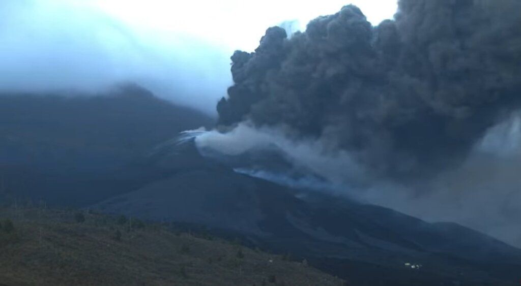
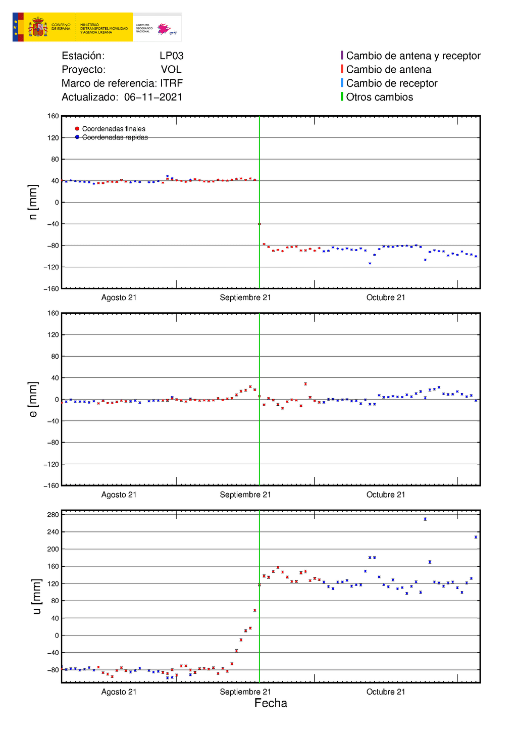
This morning, the activity at the vent increasedas our correspondent from Volcanes de Canarias reported through their twitter channel.
|
Volcanes de Canarias
 @VolcansCanarias
Eruption 07.57h. The fresh ash ejection restores vigor. Increase in seismic / tremor energy. New deformation in Jedey / Fuenca. To wait for evolution. VC Images / Erupción 07.57h. Recupera el vigor la eyección de ceniza fresca. Incremento de energía sísmica/tremor. Nueva deformación en Jedey/Fuenca. A esperar evolución. Imágenes VC/ Translate Tweet
|
However, more worrying probably is a renewed ground uplift signal of 10 cm since yesterdayon the closest GPS station, measuring now approx. 24 cm above the level before the eruption. If the data is a correct reading, it likely implies a new magma batchthat intruded at depth and likely will cause another surge of activity in the near future.
spacer
UPDATE: 11/05/2021; 11:07:03 PM
Nov 5, 2021
Hello, I’m a Bushcraft Bear and share the latest information about the current volcanic eruption on the island of la palma in my videos. If you would like to support my YouTube channel, you are welcome to do so here:
UPDATE: 11/05/2021; 9:19:01 PM
spacer

spacer
Some Collaboration for NY PREPPER:
|
Really thinking it is a new small vent…heard all the “nay say” but it does looks suspicious. Great finds from Guess we see what tomorrow brings! |
UPDATE: 11/05/2021; 4:15:05 PM
spacer
Nov 5, 2021
spacer
spacer
spacer
https://twitter.com/involcan/status/1456699873164734469/photo/1
|
|
spacer
s
UPDATE: 11/05/2021; 2:40:48 PM
spacer
There is significant rise in deformation, in Sulfure Dioxide and Carbon Dioxide, and tremors are on the rise again. The ash and lava flow remain active. These all point to the fact that MAGMA is arriving from beneath.
![]()
La Palma volcano update: Activity slows down while ground deformation and gas emissions pick up
17:26 PM | BY: T

Both the visible eruptive activity at the vent and the lava flows as well as internal seismic activity have been lower today overall. Ash emissions are more intermittent and less intense since the marked drop in volcanic tremor yesterday.
This morning, the ash plume reached 8,000 ft (2.4 km) altitude, but it has no longer been continuous. The lava flows remain active. So far, they have covered an area of nearly 10 square kilometers and destroyed 2581 houses according to official sources.
While this might look as if the peak of the eruption is over and it might be in a phase of dying down slowly, tremor remains significant, and even has been increasing again in the past 6 hours. In addition, ground deformation has again been showing a trend of uplift, now totaling approx. 13-14 cm, suggesting that more magma is being stored at depth than what is being erupted.
Sulfur dioxide (SO2) and carbon dioxide (CO2) emissions have risenalso, to 29,000 tons per day and 1,850 tons per day, respectively. This increase fits with the model of more magma arriving at depth.
- All news about: La Palma volcano
- Information about: La Palma volcano
Previous news
spacer
UPDATE: 11/05/2021; 2:26:13 PM
spacer
Even if they can get to it, and have the strength and the manpower to MOVE IT, WHERE WOULD THEY PUT IT?

Six weeks after a volcano erupted on the Spanish island of La Palma, vast amounts of ash and lava continued to cover buildings and farmland.
Spain’s military emergency unit (UME) and ground army were working in the exclusion area, removing ash from the roofs of buildings.
According to emergency officials, some lava flows reached a height of 40 meters (over 130 feet) as strong magma overflows from the previous days didn’t advance much.
Flows of molten rock from the Cumbre Vieja volcano itself have caused the evacuations of about 7,500 people and destroyed more than 2,500 buildings, mostly homes.
The rivers of lava cover over 970 hectares of mostly farmland.
Other than in an area on the island’s western side, life continues as normal for La Palma’s 85,000 residents except for having to clean up volcanic ashes.
Source: Euro News


spacer

Expert warns that rain in October could “knock down” buildings on La Palma.
A volcanologist has issued warnings regarding the danger of rain in the future. According to the expert when rain mixes with the volcanic ash which has accumulated it could “knock down” buildings.
David Calvo is the spokesman for the Volcanological Institute of the Canary Islands (Involcal). On Tuesday he explained that rain is expected on La Palma in October. The authorities need to plan now for how to deal with ash that was already fallen.
Calvo explained that due to the volume of ash that has fallen cars will be unable to pass in some areas and will run aground. He highlighted that when rain falls the ash will become tremendously heavy. The expert said this could even “topple” buildings.
The volcanologist has said it is necessary to clean evacuated areas thoroughly. This includes entrances to houses as ash is covering everything.
Since the volcano erupted, ash has covered more than 1,300 hectares, according to the European Copernicus Earth observation satellite system.
Ash is dangerous to health too and can damage the respiratory tract. Many airlines have cancelled flights both to and from La Palma due to the amount of ash from the volcano.
As reported by 20 minutes, “to facilitate the work of the emergency services working on the eruption, the Cabildo of La Palma has reinforced the clearing of ash from roads and evacuation routes, a task in which the island’s town councils are collaborating, as well as the councils of Gran Canaria and Tenerife, which have sent snowploughs.”
spacer
UPDATE: 11/05/2021; 1:16:36 PM
Looks like the winter rains have begun to move into La Palma. This will be disastrous for those homes and plant life in the area that remains covered in ash. All the ash will become like cement!
Nov 5, 2021
spacer
All these beautiful trees could be destroyed!
spacer
spacer
La Palma Volcano Dumps Major Shower of Ash on Island

The Cumbre Vieja volcano on the Spanish island of La Palma dumped a major shower of fine volcanic ash on Wednesday, November 3, according to the Institute of Natural Products and Agrobiology-Superior Council of Scientific Investigations (IPNA–CSIC).
This video by the IPNA–CSIC shows trees poking above ash on La Palma. The IPNA–CSIC said the ash “leaves a bleak panorama in large areas of the Canarian pine forest located in the vicinity of the crater.”
By November 2, the lava flow covered 997.9 hectares (approximately 3.85 square miles), according to the European Union’s Copernicus satellite program. New beaches formed from the growing lava deltas, IPNA–CISC said. Credit: IPNA–CSIC via Storyful
spacer
UPDATE: 11/05/2021; 12:37:32 PM
spacer
I wondered why they were spending so much time and money (bringing in volunteers and military) to clear the rooftops of homes that were nearly completely covered anyway. Well today, I learned the reason. TO AVOID LANDSLIDES… Makes good sense!
Improves air quality on La Palma I BRAND
spacer
UPDATE: 11/05/202110:56:19 AM
spacer
Day 48: Sunrise at the La Palma Volcano, Canary Islands
Nov 5, 2021
spacer
Apparently, the videos shared by Hal Turner and Off Grid Prepper were inaccurate. There are not other volcanos activated. I have to say that I appreciate how easy it is to get the information wrong when they keep us in the dark with no english subtitiles or translations. It is hard to put together a true picture of what is going on in La Palma from over here in the US based solely on visuals and online translators.
NO ONE out here trying to share the truth is out to scare people! That is truly not our intent. Just to give folks a fighting chance in the case of a true catastrophe. We aim to warn people at the earliest possible moment.
spacer
Pepe Cuevas placeholder image
what lost in translation can be harmful and misleading

Pepe Cuevas placeholder image
my main goal here is making this chat bilingual, now this is one of the reasons too
Pepe Cuevas placeholder image
@Granny Gear they did already
Pepe Cuevas
@Paul Winter i reported it to youtube, is not even a new volcano
Carlos B
!tsu
UPDATE: 11/05/2021; 10:06:19 AM
spacer
I don’t know if this is truly a current pic. They do not state anywhere on these videos if they are truly live or old vids from live views.

spacer
 is still crowing every morning, but starting to sound rough. But hey, he’s still on the job, even if the
  is trying to block his view.
Nov 5, 2021
 to yall please take care of each other, its quite a roller coaster ride for us all


 Repent, believe in the Gospel, Be Born Again
spacer
WOW… This is all I can get anywhere today!! Unbelievable. It tells us nothing.
Friday, November 5, 2021 14:03 GMT (31 earthquakes) Largest a 4.5 @ 11:05 pm

Streamed live 4 hours ago
 More news at:
 spacer
UPDATE: 11/05/2021; 2:08:01 AM

spacer
Even the little tiny bit they are showing us is pretty bad folks. That thick DARK SMOKE rising up from the vent is a bad sign! It means there is a lot of magma building up.
They are hiding more than you want to believe. They are manipulating this entire event and they do not want any video evidence.
spacer
Weather Manipulation… La Palma Volcano??? (bitchute.com)

spacer
 LA PALMA VOLCANO
  WEATHER WARFARE FREQUENCY SIGNATURE CAUGHT ON RADAR
Demon Hunter : SkyDome Atlantis
November 4th, 2021.
Pls. disregard up to 5 Thumbs down 

TO WATCH THIS VIDEO ON BITCHUTE:CLICK HERE

spacer
LA PALMA ERUPTION AND TSUNAMI THREAT: LESSONS FROM OPERATION BLACKJACK, I, PET GOAT II, AND BTTF
spacer
PREDICTIVE PROGRAMMING “SECRET FILES 2” (2009 GAME) LA PALMA VOLCANO CUMBRE VIEJA MEGA TSUNAMI NYC
October 25th, 2021.

spacer
UPDATE: 11/04/2021; 11:12:51 PM
spacer

spacer
spacer
 World
World

Earlier today, this website reported a second eruption had begun on the island of LaPalma in the Canary Islands; tonight we can report a THIRD eruption has now begun, THREE MILES northeast of the largest (and initial) eruption.
This third eruption is taking place at Refugio del Pilar as shown on the map below:

Video of this third eruption is now available from the official government entity on the Canary Islands which tracks volcanos, called INVOLCAN. Here is their video:
spacer
spacer
This marks a very dramatic escalation in the situation on LaPalma, and fits with information we have been reporting that the island was showing dramatic lift along it’s northern quarter, and that a massive amount of Magma was coming up from underground. (Story HERE)
In that story linked just above, we reported that a Government Geologist claimed a Magnitude 5.0 earthquake on the island on Saturday was the largest earthquake in FIFTY YEARS and he believed it was due to enormous magma intrusion coming up from earth’s mantle. He came to this conclusion on Sunday, when LaPalma encountered its SECOND Magnitude 5.0 earthquake that day . . . just one day after its first 5.0 quake.
The Geologist explained that it took 6 weeks of eruption before the first Magnitude 5 quake, but only 24 hours to have ANOTHER 5.0 quake. He said he believed that the amount of magma coming up was so gigantic, it could cause the island to . . . explode. (Story continues beneath Ads)
This morning, this web site reported on a new (second) eruption, about 1 mile from the large, ongoing, eruption. A new eruption gives credence to the government geologist belief that enormous magma was coming up.
Tonight, we can report that a THIRD eruption, three to four MILES northeast of the original, erupting volcano, is now also spewing, which backs what the Government Geologist told us, and which we reported to you.
Whether or not LaPalma explodes, there is an unstable landmass on the southwest flank of that island, which slid 13 feet down toward the ocean in a 1949 eruption. It slid, then stopped.
If that unstable landmass slides into the ocean, scientists say it could generate an Atlantic-wide tsunami that would reach the east coast of north America 7 to 8 hours later, inundating every major city along the east coast.
Life as we know it, would be changed forever as all those cities were wiped out.
People living on the east coast are URGED to have an evacuation plan, have a “go-bag” for each family member with clothes, some food, and other things already packed, so if the landslide happens, you can “bug-out” to a safe location.
It is not known if there would be ANY government warnings of the inbound tsunami, and if there are, try to imagine tens-of-millions of people trying to flee for their lives. If you think “rush hour” is bad with just the people going to or from work, amplify that 100 times or more when EVERYONE is trying to flee.
Roads would become blocked almost immediately, and panicked people might literally go “Mad Max” trying to get away.
If you wait until a government warning comes out, then YOU will be with all those panicked people, stuck on highways due to traffic. That’s why you must monitor the situation closely and if you hear that a landslide has taken place, you need to get out right away.
You need to go BEFORE the masses (who never plan for anything) are told to flee, and they screw up everything.
The situation on LaPalma is getting very much worse. Monitor the situation and have an evacuation plan. Know where you will go and how you intend to get there. Have an alternate route planned in case your primary route is blocked. Have cash money . . . if the banks in New York City get wiped out by a tsunami, you may not be able to use your credit or debit cards because the banks won’t exist to approve the charges. So cash will be king. Have some.
More info as we get it . . . .
spacer
UPDATE: 11/04/2021; 10:41:45 PM
| Nov 4, 2021 11:05 pm (GMT +0) (Nov 4, 2021 23:05 GMT) 4 hours ago |
4.5
35 km |
La Palma Island, 16 km southeast of Los Llanos de Aridane, Spain I FELT IT – 45 reports |
UPDATE: 11/04/2021; 6:52:27 PM
spacer

spacer
Nov 4, 2021
spacer
SCHEDULED TO START AT 7:00PM
LA PALMA UPDATE!!
Scheduled for Nov 4, 2021
spacer
I am glad I was not the only one who saw the demon in this shot.
spacer
 0cTViA—GTFO of MY Life
@GEMINiTwin2wist
#LaPalma It’s important to note the unique properties of this island and it’s many historical volcano sites… Everyone should be paying attention to this! #canaryIslands #Spain #CumbreVieja #volcano #LaPalmaEruption
|
spacer
UPDATE: 11/04/2021: 4:43:29 PM
spacer
spacer
109 quakes reported so far today
Streamed live 112 minutes ago
THERE HAS BEEN A SECOND VOLCANO THAT HAS STARTED TO ERUPT ON LA PALMA APPROX 1 MILE AWAY FROM THE MAIN CONE. ACTIVITY CONTINUES WITH NO END IN SITE, EARTHQUAKES HAVE ALSO INCREASED IN THE LAST 12 HRS, THIS ERUPTION IS FAR FROM OVER. SECOND ERUPTION BEGINS ON LAPALMA: COGOTE MOUNTAIN https://halturnerradioshow.com/index…. Fears Island “May Explode” — Serious Ground Deformation, Large Area of Northern LaPalma Island
spacer
spacer
 World
World
A second volcanic eruption has begun on the island of LaPalma, Canary Islands, Atlantic Ocean, off the northwest coast of Africa. Cogote Mountain, the site of a smaller fissure decades ago, is now erupting.
The satellite image below shows Cogote Mountain in relation to the other, ongoing, eruption of the Cumbre Viejo volcano. They are significantly separated by about a full MILE:

The new eruption is separated from the ongoing eruption by one MILE, so this is not some new “vent” – it seems to be its own eruption:

Video of the new eruption site has been posted to social media by the Canary Islands government:
spacer
spacer
Apparently, people on the island are also experiencing activity on the EAST SIDE of the ISLAND!
spacer
Again earthquake measured at 3.6They last 2-3 seconds, super brief. And all are centered at same location on the eastside of the island, some 10-15 km from volcano,close to the airport. Why there?…maybe another volcano is going to erupt at Villa de Mazo? Many people on La Palma have sleepless nights and I feel sorry for them. A local girl at coffee shop confessed that she can not sleep at night. As all these strong earthquakes take place at night like around 3 am, 5,50 am and 7,20 am.
spacer
UPDATE: 11/04/2021; 11:20:04 AM
spacer
spacer
Streamed live 3 hours ago
from Todoque ———————————————— —————— 

spacer
spacer
![]()
La Palma, Canary Islands: eruption Sep 2021 – updates
Activity continues with little changes, weak increase in tremor
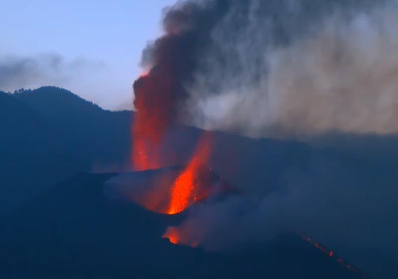
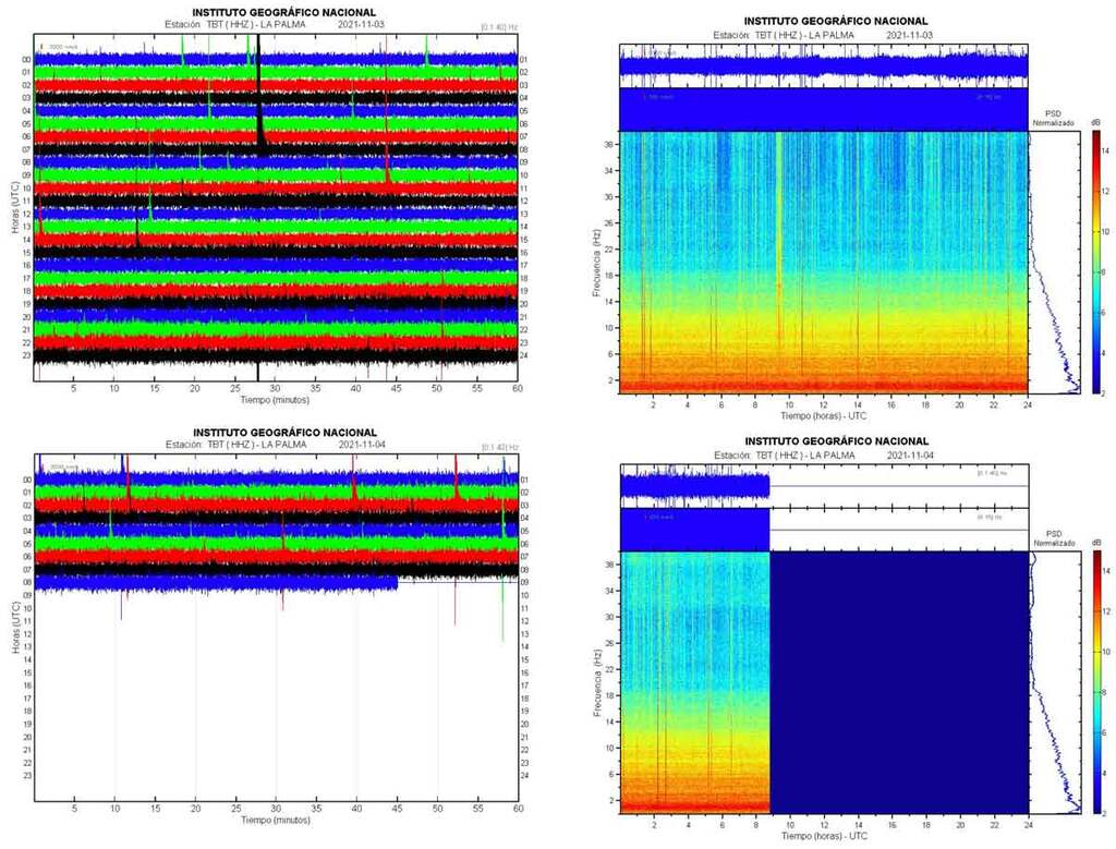
The eruption continues with no significant changes in observed and measured parameters.
At the cone, several vents remain active with near-continuous pulsating ash-rich lava fountains, as well as intermittent stronger explosions, generating an ash plume rising approx. 2 km today. Most of the erupted lava is directly entering the lava tube system from the lower vents.
Volcanic tremor has increased again compared to yesterday, but still remains lower than the average of the past weeks. Whether its amplitude corresponds to the lava output rate is in parts speculation; visually, the latter seems to be reduced at the moment.
The lava flows did not advance significantly over the past 24 hours, with nearly all activity occurring along the southern margins of the active flow field.
Trade winds today are carrying the ash plume, approx. 2 km high, towards the SW over the ocean, which is good for the airport on the east side to be operational.
Earthquakes:
During the past 24 hours, 119 quakes of magnitudes from 2.3 up to 3.7 maximumhave been registered under the volcano as of this update. Larger ones have been absent since the 5.1 event yesterday morning, but this can of course change again quickly.
spacer
Nov 4, 2021
spacer
The TVE program “La Hora de La 1” interviews Rosa María Mateos, a geologist at the Geological and Mining Institute of Spain. The eruption of the Cumbre Vieja volcano, on the Canary Island of La Palma, is on its 45th day of activity with some “positive signs”, such as the decrease in volcanic tremor and sulfur dioxide, which make scientists think that the The end of the eruption of the Cumbre Vieja volcano on La Palma is closer, although the phenomenon continues and worries about the worsening of air quality. However, experts insist that you have to wait at least 5 days to see if the good news is confirmed. #The Palm #Ash #RashLaPalma #Earthquake #Seism #VolcanoLaPalma #Volcano #Eruption #OldSummer #Canary Islands #The plains #Tazacorte #Wash #Magma #Wash #Earthquakes #coronavirus # covid19 #news #LiveNews #StreamingNews #Spain #spanishnews
spacer
Nov 4, 2021
spacer
Oct 4, 2021
spacer
Nov 4, 2021
Hello, I’m a Bushcraft Bear and share the latest information about the current volcanic eruption on the island of la palma in my videos. If you would like to support my YouTube channel, you are welcome to do so here:
spacer
Nov 4, 2021
Wednesday, November 3. We are talking about earthquakes, lava flows, ash cloud…. We will collect all the data that you have provided from PEVOLCA. The seismic activity remains in the same areas and depths, with a magnitude 5 earthquake in the early morning. As for the washes, we put them with the official numbers so that they can be identified. The only one that has advanced in the last hours is wash 11, about 150 meters. Flows 3 and 9 continue to receive material input and in the rest, the “filling” is basically being produced in some “islands” that were left without receiving lava. Hence, the affected area is 981 hectares (4 hectares more than yesterday). air quality continues to show unfavorable levels. The ash cloud has turned to the south and that favors air operation.
spacer
UPDATE: 11/03/2021; 1:28:24 AM
While there have been posts telling people that the Situation may be coming to an end, the facts point in the opposite direction! In fact there are reports that the Situation has shown signs that the Island may be about to EXPLODE!!
spacer
|
|
spacer
Fears Island “May Explode” — Serious Ground Deformation, Large Area of Northern LaPalma Island
ByMorgan
NOV 4, 2021 Canary Island, Deformation, Earthquakes, Explode, Fears, Island, LaPalma, Spain, Volcano

A very large section of the island of LaPalma, in the Canary Islands, Atlantic Ocean, off the northwest coast of Africa, is showing very significant swelling: 20 CM in the pas day alone, giving rise to one Geologists belief that such enormous magma is moving upwards, the entire island __MAY__ explode.
Over this past weekend, the island of LaPalms experienced it’s first Magnitude 5.0 earthquake in fifty years. Largest quake in FIFTY years! Then, on Sunday . . . just 24 hours later, the island suffered ANOTHER Magnitude 5.0 quake.
One geologist, who works for a government (I won’t say which gov’t) told me on Sunday afternoon “It took 6 weeks of eruption before the island got it’s 5.0 earthquake. Then, afterwards, it only took 24 HOURS to build up enough underground pressure, to give the island ANOTHER 5.0 quake.”
I asked the Geologist why he thought this was important, and he replied “I think that magma is moving up from earth’s Mantle, in such enormous amounts, that the island of LaPalma could actually explode from it.”
I was shocked at such a possibility and asked him when? He replied “It’s only a remote possibility, and it is highly UNLIKELY, but I think it __could__ happen within the next 48 hours or so.” He went on to say, “What you need to watch for, is widespread ground deformation. THAT will be the sign that so much magma is moving up so fast, the island (and erupting volcano) can’t handle it all. If you see widespread ground deformation, I think that will be the sign that the island is lost.”
Now, it is important for me to point out to readers that this is ONE man’s view. And he went to great lengths to tell me it is “UNLIKELY” and “a very REMOTE possibility.” Yet, what struck me was the fact that he told me this at all.
Scientists are not given to wild, unsubstantiated, claims. To make such claims would destroy their careers and professional reputations; they’d be ruined. Yet, this Geologist told me these things.
I passed this information along to listeners to my radio show on Monday, and again on Tuesday.
Today, Wednesday, November 3, 2021, I looked at the National Geographic Institute of Spain to see what the ground deformation of LaPalma looked like. I was shocked.
Below is the official Ground Deformation report for LaPalma from yesterday, November 2. It shows the entire northern quarter of the island is now showing widespread ground deformation . . . uplift . . . the red is 20cm, the yellow is 10-15 cm.
This seems to ME to be the exact type of widespread land changes the geologist told me to watch for. Here’s the official government report map:

QUAKES GETTING MORE SHALLOW
In the meantime, earthquakes on the island continue to become more SHALLOW . . . closer to the surface:
| Magnitude: ML 3.6 Region: CANARY ISLANDS, SPAIN REGION Date time: 2021-11-04 02:11:24.5 UTC Location: 28.56 N ; 17.84 W Depth: 9 km |
Direct link HERE
And here:

Source: halturnerradioshow.com
 World
World
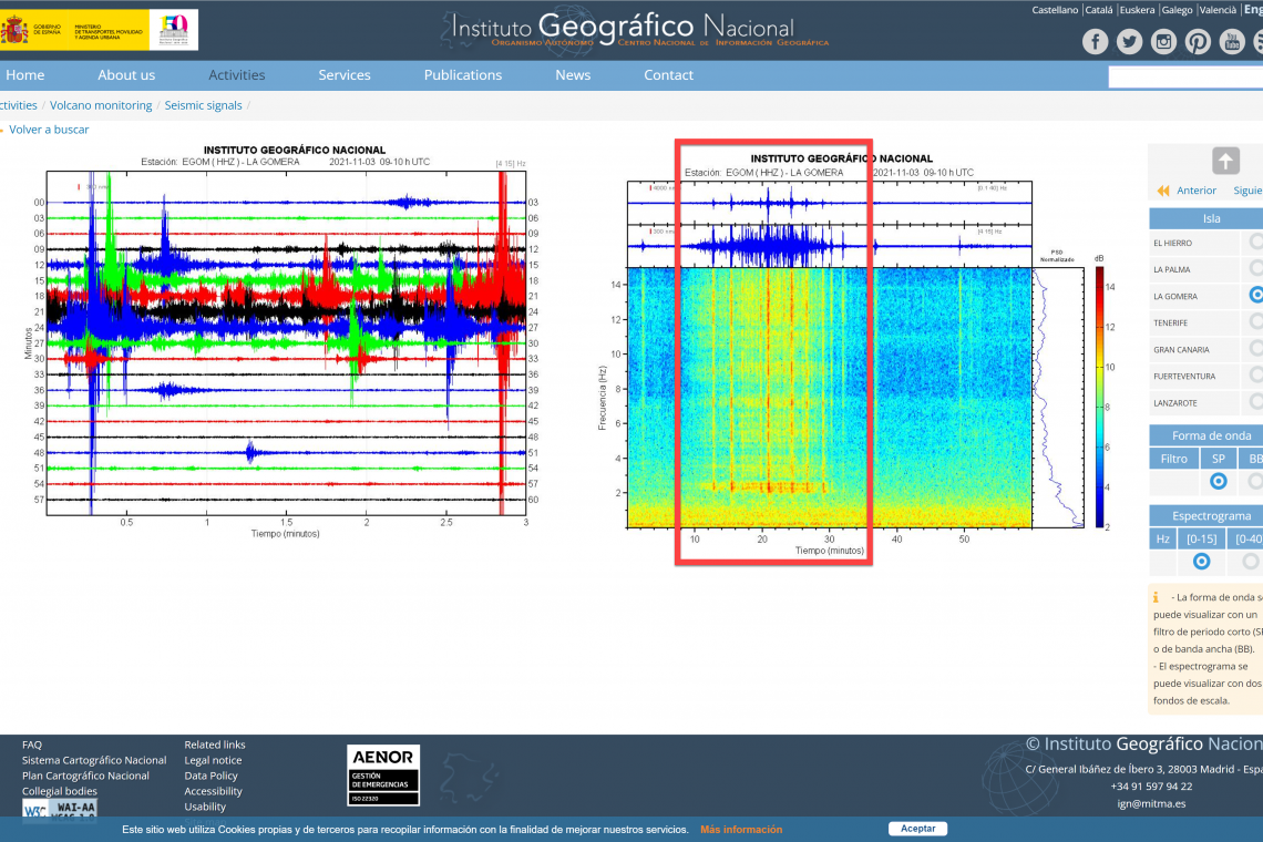
An earthquake struck the island of LaPalma in the Canary Islands this morning, and the shaking lasted . . . . 20 MINUTES!
Below is the LaPalma Seismograph showing the 20 minute quake, but the readings are obfuscated by all the local volcano eruption noise, so below is ANOTHER seismo reading from nearby LaGomera island, without so much volcano noise (from LaPalma) and you can clearly see the 20 minute quake which took place on LaPalma, on its readings:

Here’s the report from nearby LaGomera island, in the same Canary Islands, showing the 20 minute LaPalma quake much more clearly (less volcano noise) from the Canary Islands Government:

spacer
UPDATE: 11/03/2021; 12:55:40 AM
spacer
The ash and pyroclaststhat a volcano emits are initially neutral (without electrical charge), but the friction between them in a certainly hostile environment (fiery) causes the release of ions within the volcanic plume.
Only when this happens, that is, when the volcanic cloud has differences in electrical charges, volcanic lightning is produced.
Consequences and curiosities of volcanic lightning
An important consequence of these thunderstorms is that they can affect communications: lightning can interfere and have a negative impact on aviation.
Likewise, radio communications would be affected both in the air and at nearby airports. A study carried out by Stephen R. McNutt and Earle R. Williams, from the Alaska Geophysical Institute and the Massachusetts Institute respectively, confirm that “lightning and electrification in volcanoes are important because they represent a danger in themselves.
SOURCE
spacer
spacer
And here is the Lightning Strike that was captured by Bushcraft Bear last night, when he said he had seen more than one strike.

spacer

Although earthquake magnitude is one factor that affects tsunami generation, there are other important factors to consider. The earthquake must be a shallow marine event that displaces the seafloor. Thrust earthquakes (as opposed to strike slip) are far more likely to generate tsunamis, but small tsunamis have occurred in a few cases from large (i.e., > M8) strike-slip earthquakes.
Note the following general guidelines based on historical observations and in accordance with procedures of the Pacific Tsunami Warning Center.
Magnitudes below 6.5
Earthquakes of this magnitude are very unlikely to trigger a tsunami.
Magnitudes between 6.5 and 7.5
Earthquakes of this size do not usually produce destructive tsunamis. However, small sea level changes might be observed in the vicinity of the epicenter. Tsunamis capable of producing damage or casualties are rare in this magnitude range but have occurred due to secondary effects such as landslides or submarine slumps.
Magnitudes between 7.6 and 7.8
Earthquakes of this size might produce destructive tsunamis, especially near the epicenter. At greater distances, small sea level changes might be observed. Tsunamis capable of producing damage at great distances are rare in the magnitude range.
Magnitude 7.9 and greater
Destructive local tsunamis are possible near the epicenter, and significant sea level changes and damage might occur in a broader region. Note that with a magnitude 9.0 earthquake, there is a possibility of an aftershock of magnitude 7.5 or greater.
Keep in mind that this particular situation is complicated by the geological structure of the island, the fault line and the rift or tear caused by previous eruptions/earthquakes. So, the it may take much less in this case to cause the island to split and a large portion fall off into the ocean. If you have not seen the videos predicting this possibility, you need to watch them.
It does not look to me like the volcano is getting ready to end The earthquakes are still very frequent and as you can see below, so far today, they are all very shallow!
spacer
Date and time |
Mag Depth |
Location |
| Thursday, November 4, 2021 06:30 GMT (48 earthquakes) ALREADY TODAY! | ||
| Nov 4, 2021 6:30 am (GMT +0) (Nov 4, 2021 06:30 GMT) 6 minutes ago |
3.6
11 km |
CANARY ISLANDS, SPAIN REGION I FELT IT |
| Nov 4, 2021 6:20 am (GMT +0) (Nov 4, 2021 06:20 GMT) 15 minutes ago |
3.0
11 km |
Spain: N FUENCALIENTE DE LA PALMA.ILP I FELT IT |
| Nov 4, 2021 6:05 am (GMT +0) (Nov 4, 2021 06:05 GMT) 31 minutes ago |
2.7
35 km |
La Palma Island, 11 km southeast of Los Llanos de Aridane, Spain |
| Nov 4, 2021 5:57 am (GMT +0) (Nov 4, 2021 05:57 GMT) 38 minutes ago |
3.4
14 km |
La Palma Island, 11 km south of Los Llanos de Aridane, Spain I FELT IT – 1 report |
| Nov 4, 2021 4:50 am (GMT +0) (Nov 4, 2021 04:50 GMT) 57 minutes ago |
2.5
11 km |
La Palma Island, 13 km southeast of Los Llanos de Aridane, Spain |
| Nov 4, 2021 4:49 am (GMT +0) (Nov 4, 2021 04:49 GMT) 58 minutes ago |
2.5
14 km |
La Palma Island, 14 km southeast of Los Llanos de Aridane, Spain |
| Nov 4, 2021 4:42 am (GMT +0) (Nov 4, 2021 04:42 GMT) 1 hour 5 minutes ago |
3.0
13 km |
La Palma Island, 14 km southeast of Los Llanos de Aridane, Spain I FELT IT |
| Nov 4, 2021 4:38 am (GMT +0) (Nov 4, 2021 04:38 GMT) 1 hour 9 minutes ago |
2.7
8 km |
La Palma Island, 14 km southeast of Los Llanos de Aridane, Spain I FELT IT |
| Nov 4, 2021 4:15 am (GMT +0) (Nov 4, 2021 04:15 GMT) 1 hour 32 minutes ago |
2.8
11 km |
La Palma Island, 13 km southeast of Los Llanos de Aridane, Spain |
| Nov 4, 2021 4:12 am (GMT +0) (Nov 4, 2021 04:12 GMT) 1 hour 34 minutes ago |
3.0
13 km |
La Palma Island, 13 km southeast of Los Llanos de Aridane, Spain I FELT IT |
| Nov 4, 2021 3:46 am (GMT +0) (Nov 4, 2021 03:46 GMT) 2 hours 1 minutes ago |
3.2
10 km |
La Palma Island, 13 km southeast of Los Llanos de Aridane, Spain I FELT IT |
| Nov 4, 2021 3:42 am (GMT +0) (Nov 4, 2021 03:42 GMT) 2 hours 5 minutes ago |
3.2
13 km |
La Palma Island, 13 km southeast of Los Llanos de Aridane, Spain I FELT IT |
| Nov 4, 2021 3:40 am (GMT +0) (Nov 4, 2021 03:40 GMT) 2 hours 7 minutes ago |
3.1
12 km |
La Palma Island, 14 km southeast of Los Llanos de Aridane, Spain I FELT IT |
| Nov 4, 2021 3:25 am (GMT +0) (Nov 4, 2021 03:25 GMT) 2 hours 22 minutes ago |
2.8
13 km |
La Palma Island, 14 km southeast of Los Llanos de Aridane, Spain |
| Nov 4, 2021 3:17 am (GMT +0) (Nov 4, 2021 03:17 GMT) 2 hours 30 minutes ago |
2.4
8 km |
La Palma Island, 14 km southeast of Los Llanos de Aridane, Spain |
| Nov 4, 2021 3:11 am (GMT +0) (Nov 4, 2021 03:11 GMT) 2 hours 36 minutes ago |
3.4
12 km |
La Palma Island, 13 km southeast of Los Llanos de Aridane, Spain I FELT IT |
| Nov 4, 2021 3:06 am (GMT +0) (Nov 4, 2021 03:06 GMT) 2 hours 41 minutes ago |
3.4
11 km |
La Palma Island, 14 km southeast of Los Llanos de Aridane, Spain I FELT IT – 1 report |
| Nov 4, 2021 3:04 am (GMT +0) (Nov 4, 2021 03:04 GMT) 2 hours 43 minutes ago |
2.6
10 km |
La Palma Island, 14 km southeast of Los Llano |
| Nov 4, 2021 2:14 am (GMT +0) (Nov 4, 2021 02:14 GMT) 2 hours 23 minutes ago |
2.9
14 km |
La Palma Island, 14 km southeast of Los Llanos de Aridane, Spain |
| Nov 4, 2021 2:11 am (GMT +0) (Nov 4, 2021 02:11 GMT) 2 hours 26 minutes ago |
3.6
9 km |
La Palma Island, 13 km southeast of Los Llanos de Aridane, Spain I FELT IT – 9 reports |
| Nov 4, 2021 2:02 am (GMT +0) (Nov 4, 2021 02:02 GMT) 2 hours 35 minutes ago |
2.5
10 km |
La Palma Island, 11 km southeast of Los Llanos de Aridane, Spain |
| Nov 4, 2021 1:53 am (GMT +0) (Nov 4, 2021 01:53 GMT) 2 hours 44 minutes ago |
2.7
10 km |
La Palma Island, 13 km southeast of Los Llanos de Aridane, Spain |
| Nov 4, 2021 1:46 am (GMT +0) (Nov 4, 2021 01:46 GMT) 2 hours 51 minutes ago |
2.9
11 km |
La Palma Island, 12 km southeast of Los Llanos de Aridane, Spain |
| Nov 4, 2021 1:37 am (GMT +0) (Nov 4, 2021 01:37 GMT) 2 hours 60 minutes ago |
2.5
9 km |
La Palma Island, 12 km southeast of Los Llanos de Aridane, Spain |
| Nov 4, 2021 1:31 am (GMT +0) (Nov 4, 2021 01:31 GMT) 3 hours 5 minutes ago |
2.6
11 km |
La Palma Island, 14 km southeast of Los Llanos de Aridane, Spain |
| Nov 4, 2021 12:59 am (GMT +0) (Nov 4, 2021 00:59 GMT) 3 hours 38 minutes ago |
2.6
14 km |
La Palma Island, 13 km southeast of Los Llanos de Aridane, Spain |
| Nov 4, 2021 12:58 am (GMT +0) (Nov 4, 2021 00:58 GMT) 3 hours 39 minutes ago |
3.2
10 km |
La Palma Island, 12 km southeast of Los Llanos de Aridane, Spain I FELT IT |
| Nov 4, 2021 12:49 am (GMT +0) (Nov 4, 2021 00:49 GMT) 3 hours 47 minutes ago |
2.7
13 km |
La Palma Island, 14 km southeast of Los Llanos de Aridane, Spain |
| Nov 4, 2021 12:48 am (GMT +0) (Nov 4, 2021 00:48 GMT) 3 hours 48 minutes ago |
2.4
9 km |
La Palma Island, 10.5 km southeast of Los Llanos de Aridane, Spain |
| Nov 4, 2021 12:44 am (GMT +0) (Nov 4, 2021 00:44 GMT) 3 hours 53 minutes ago |
2.7
14 km |
La Palma Island, 14 km southeast of Los Llanos de Aridane, Spain |
| Nov 4, 2021 12:41 am (GMT +0) (Nov 4, 2021 00:41 GMT) 3 hours 55 minutes ago |
2.8
11 km |
La Palma Island, 11 km southeast of Los Llanos de Aridane, Spain1 report |
| Nov 4, 2021 12:24 am (GMT +0) (Nov 4, 2021 00:24 GMT) 4 hours ago |
2.4
10 km |
La Palma Island, 13 km southeast of Los Llanos de Aridane, Spain |
| Nov 4, 2021 12:23 am (GMT +0) (Nov 4, 2021 00:23 GMT) 4 hours ago |
2.5
15 km |
Spain: NE FUENCALIENTE DE LA PALMA.IL |
| Nov 4, 2021 12:10 am (GMT +0) (Nov 4, 2021 00:10 GMT) 4 hours ago |
3.5
9 km |
La Palma Island, 13 km southeast of Los Llanos de Aridane, Spain I FELT IT – 5 reports |
| Nov 4, 2021 12:05 am (GMT +0) (Nov 4, 2021 00:05 GMT) 5 hours ago |
2.8
15 km |
La Palma Island, 15 km southeast of Los Llanos de Aridane, Spain |
| Nov 4, 2021 12:00 am (GMT +0) (Nov 4, 2021 00:00 GMT) 5 hours ago |
3.4
12 km |
La Palma Island, 14 km southeast of Los Llanos de Aridane, Spain I FELT IT – 2 reports |
| Wednesday, November 3, 2021 23:55 GMT (67 earthquakes) | ||
!
spacer
Nov 3, 2021
UPDATE: 11/03/2021: 11:04:53 PM
spacer
 AhoraegGOL AhoraegGOL @AhoraegGOL
gol.ahoraeg.com
The “positive signs” that may anticipate the end of the eruption on La Palma
The Cumbre Vieja volcano has been erupting for more than a month and at the moment, it continues without respite. The ejected lava has wiped out about a thousand hectares
|
spacer
Nov 3, 2021
spacer
Nov 3, 2021
spacer
UPDATE: 11/03/2021: 5:00:02 PM
Streamed live 3 hours ago
spacer

More than 7,000 people have been evacuated since the volcano first erupted on September 19.
What do we know about the situation on La Palma?
Schools have been closed and all flights canceled because of the ash.
The regional government described the air quality this week on the island as “extremely unfavorable.”
La Palma, which is part of the Canary Islands off Africa’s northwest coast, has a population of about 85,000 people.
The eruption has damaged more than 2,000 buildings and covered hundreds of hectares with lava.
It’s unclear when the volcanic activity on the island will end — scientists have said the eruption could last up to three months.
No casualties have been reported so far.
spacer
The volcano that erupted on September 19, 2021 on the island of La Palma is known as Cumbre Vieja because that is the name of the area where it is located, but it does not yet have an official name .
The Cumbre Vieja Natural Park was created in 1987 and covers the entire south-central part of the Canary Island. As the days passed, the volcano adopted the name of Cabeza de Vaca since it is the name of the exact area where the eruption point is located.
In general, these natural phenomena usually adopt the name of the place where they erupt. However, this time it seems that it will not. The volcano will not be called Cumbre Vieja or Cabeza de Vaca , but other options related to the culture and history of La Palma are being considered.
The names that the La Palma volcano could have
Jedey
The Canarian geologist Francisco García-Talavera has proposed the name of Jedey, a well-known Guanche warrior . In addition, this is how one of the areas closest to the eruption is called, which is located within the municipality of Los Llanos de Aridane.
If so called, it would be the fifth island volcano with a Guanche name , after Tacande (1430-1440), Tehuya (1585), Tigalate (1646) and Teneguía (1971).
Tajogaite
Another of the proposed names is Tajogaite, and there are already several Canarian media that are using it to refer to the volcano. It is the exact point where the first crack through which the magma emerged was located. A site that, according to the aboriginal language, means “cracked mountain .”
For now, there is no decision made. You have to wait to know the final name that the volcano will receive . Although at first the name “Cabeza de Vaca” was the most widespread, it has been losing weight over the days.
What is clear is that the name will take a long time to arrive . The underwater volcano of El Hierro, which erupted in October 2011 and lasted six months, was not named Tagoro until May 2016.
At 23:00 (Canarian time) on Tuesday, September 28, the lava from the La Palma volcano has reached the sea . It has done so on the coast of the town of Tazacorte, giving rise to an impressive deposit of more than 50 meters high.
spacer
UPDATE: 11/03/2021; 10:28:06 AM
spacer

I was awake and watching last night when the 5.1 earthquake occurred. It was very frustrating to me that I was unable to post it at the time. Last night my access to the webpage was unavailable to me. I guess they were working on it or perhaps it was hacked again and they were trying to restore it. Anyway, that upset me because I realized that I might not be able to alert you when it counts the most, for one reason or another. Believe me, I spend every available moment watching this situation and reporting it to you. I care very much about what happens to you and your families. Pray for me, please. I know many of you are already praying for me, and I can’t even tell you how much I appreciate your prayers.
spacer
LIGHT AND WATER SUPPLIES | 3D
213K subscribers
In the middle of this volcanic eruption there is an overwhelming image. In the middle of El Valle de Aridane, in the houses and streets that remain, there is no light, they are dark. The volcano has caused significant damage to basic supplies. According to data from Endesa, there are 2,377 affected clients. The lava has destroyed 65 electrical turrets and 86 km of low and medium voltage distribution cables. Even so, the houses and businesses that have not been evicted maintain the electricity supply. On the other hand, the volcano has cut off the tap to hundreds of homes and farms. Lava has destroyed the pipeline that supplied water to El Remo, Puerto Naos and La Bombilla. 2,500 people without water. Although, as we know, the area is vacated. 90% of the drinking water on La Palma is underground. The damage to the aquifers will have to be assessed.spacer
Nov 3, 2021
spacer
134 quakes, show more)

spacer
Nov 3, 2021
spacer
Nov 3, 2021
spacer
![]()
La Palma, Canary Islands: eruption Sep 2021 – updates
Ash fall deposits create increasing problems
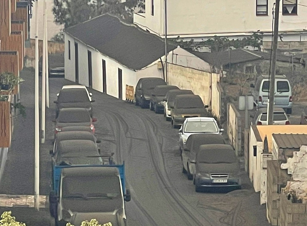
Ash fall in the Ariadne valley is increasingly a problem. More army personnel is called in to help remove the heavy load from roof and the streets before rains set in and make it much worse, as it will then form a natural cement-like mixture and increase its weight.
Source: El Valle reclama más Ejército “antes de que lleguen las lluvias” (El Time)
Lava flows advance along Camino Aniceto road
Lava flows continue to advance today along the Camino Aniceto road:
Aerial video showing craters aligned in a row
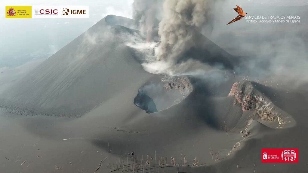
The government released a video of a drone overflight taken yesterday. It shows very nicely the configuration of the different vents aligned in a row on top of the original eruptive fissure:
Strongest-so-far quake at magnitude 5.1 at only 26 km depth under island
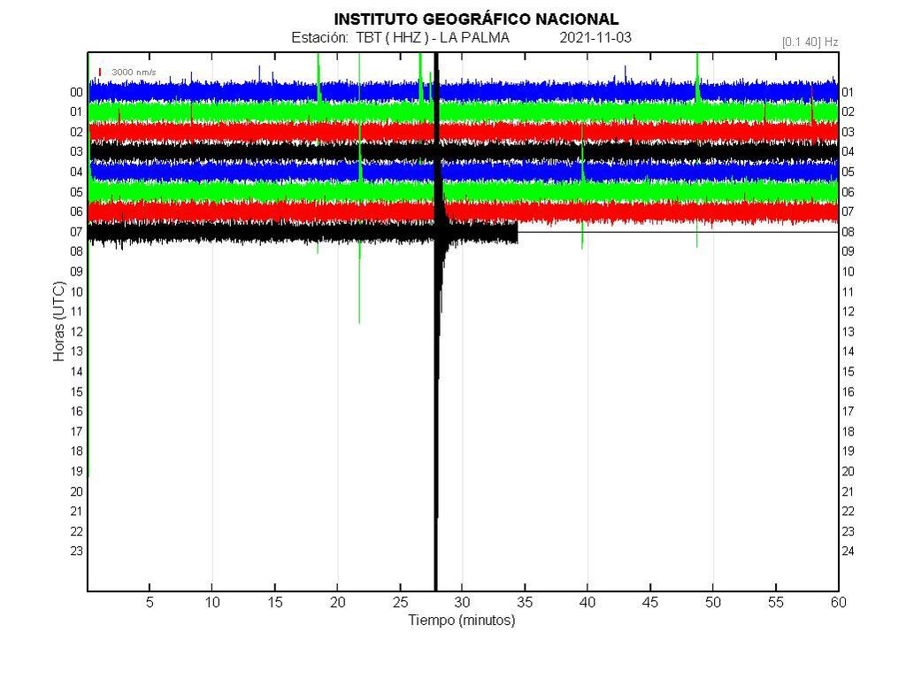
This morning’s magnitude 5.1 event, which hit at 7.27 a.m., is the strongest-so-far tremor under the volcano since the seismic crisis followed by the ongoing eruption began in September.
It was felt all over the island, and if the depth is correct of only 26 km it deviates significantly from the depth layer around 35-40 km, which has been where other stronger quakes in the range of magnitudes 4.5-5 that have occurred so far.
This could be due to new magma intrusion into intermediate layers at this depth. It will be important to see whether it will be followed by an increase of lava activity in the near future (several hours from now possibly).
Tremor remains lower, but earthquakes pick up, magnitude 5.1 this morning
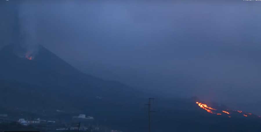
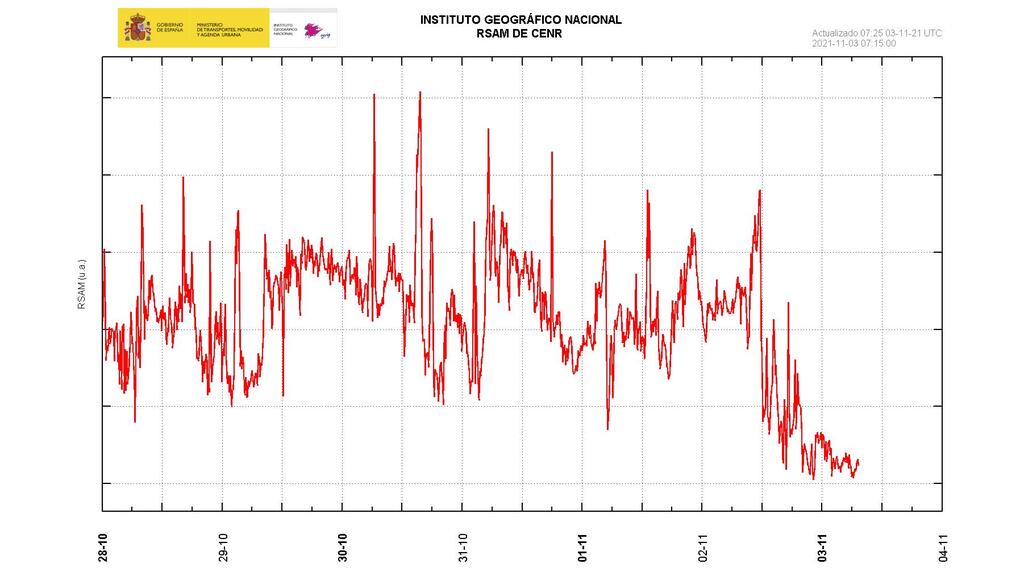
Activity continues with ash emissions from the main vent and lava effusion from the lower one, feeding most of it into a tube system.
An active lava flow breakout is visible on the webcam in the upper part of the lava flow field, but it seems to remain on top of older flows.
Volcanic tremor has continued to drop a bit, suggesting less magma is currently rising and arriving as lava, but earthquakes seem to have picked up again somewhat. Just minutes ago, a strong quake, with a preliminary magnitude of 5.1 occurred at 26 km depth minutes ago, but these data might be corrected still.
spacer
UPDATE: 11/02/2021; 7:05:01 PM
spacer
Nov 2, 2021
UPDATE: 11/02/2021; 4:40:38 PM
spacer
First Hand view from Buschcraft and GuntnTag
Most folks are using blowers to move the ash!?! That is not wise. It just reintroduces the dust particles small enough to enter human airways and cause irritation and possible further complications.
Nov 2, 2021
spacer
So much traffic!! As the idiot tourists flock to SEE! They don’t realize with all those people there, when/if disaster strikes…they will have made it impossible to find ANY CHANCE of escape.
Nov 2, 2021
spacer
UPDATE: 11/02/2021; 3:32:31 PM
spacer
![]()
La Palma, Canary Islands: eruption Sep 2021 – updates
Magnitude 4.2 quake
Just minutes after the previous update, a magnitude 4.2 quake occurred… Tremor remains unchanged.
Volcanic tremor drops to half its previous value, activity lower
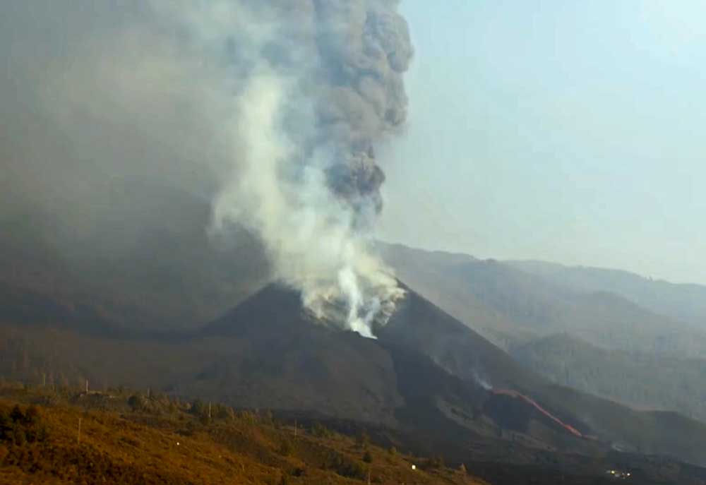
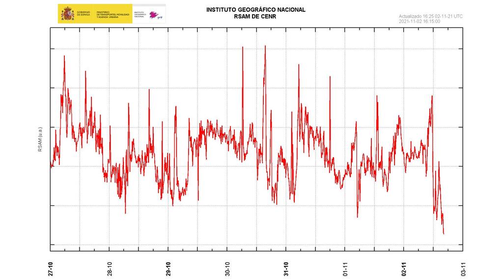
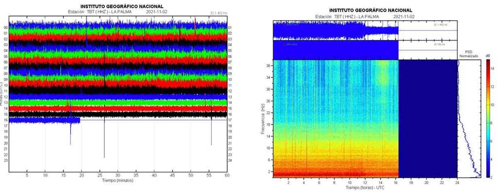
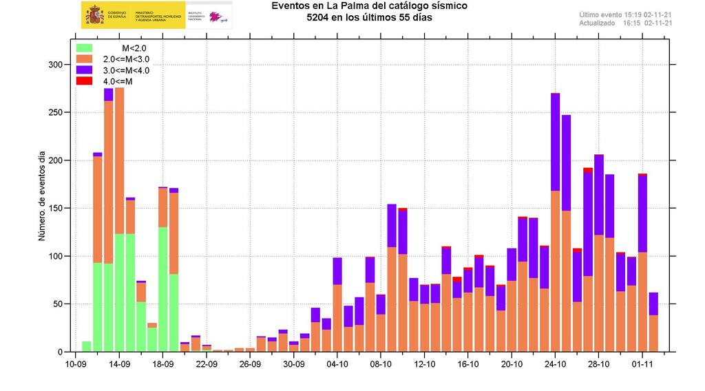
The activity has been lower on most fronts today. Most notably, volcanic tremor dropped sharply at around noon local time to about half its values of the previous days average.
Whether this correlates to reduced lava effusion is difficult to say with certainly but at least likely. Lava continues to be seen arriving at the lower vent of the cone, now approx. 200 m tall, and from there mostly flowing into the tube system, but maybe it has been less in volume during the past day. In agreement with this interpretation is that the lava flows that advanced yesterday along the southern margins of the flow field also slowed down a lot and made almost no progress today.
The area of Las Norias, which has been the most threatened to become the next victim of lava flows reaching part of the Camino Aniceto road yesterday, still remains intact for now and can thus still hope to survive.
Ash emissions from the main crater remained intense, however, and produced a plume that rose to 3-4 km this morning. Different wind regimes brought much needed relief to the Ariadne valley, allowing sunshine to reach the ash-plagued area. But when one side of the island is free from the ash, the other usually suffers… The westerly winds pushed the ash cloud to the east and northeast, with the result that the airport located on the eastern coast had to close today.
Earthquakes Today: quakes magnitude 0.1 or higher (104 quakes):magnitude 2 or higher (104 quakes): magnitude 3 or higher (42 quakes):magnitude 4 or higher (1 quakes):
Earthquakes have decreased as well to about half in numbers compared to most previous days. Since last evening’s 4.6 quake at 8.24 p.m., no other quakes of similar size have occurred, but approx. 100 quakes of magnitudes between magnitudes of 2.5-3.6.
Deformation is still elevated, but shows a weak trend of decrease. (What bothers me on this one is that the experts say the best clue we will have of an imminent tsunami is the deformation increase. Why are they not showing the deformation map like the used to on this report? In fact, I have not been able to find a current map of the deformation on La Palma ANYWHERE! What are they hiding?)
Measured gas emissions remain high, with some increase according to local news articles.
In the meanwhile, the army is helping to clean roofs from the heavy load of ash in some areas. This is particularly important to do before the (awaited) winter rains set in, which mixed with the ash create a cement-like mass and make for dangerous extra load, that could easily bring many roofs to collapse. (Winter has officially begun in La Palma)
 El Time
@ElTimeLaPalma
El Paso asks the Cabildo “more companies” and the State “more army”, to clean ashes
https://eltime.es/politica/185-instituciones/36233-el-paso-pide-al-cabildo-mas-empresas-y-al-estado-mas-ejercito-para-limpiar-cenizas.html… #noticiaslapalma #terremotoslapalma #urgencaislapalma #emergencialapalma #volcanlapalma #vigilanciaLaPalma #volcancumbrevieja #cenizasvolcán #ejercitoLaPalma
Translate Tweet
|
Latest map of lava flows
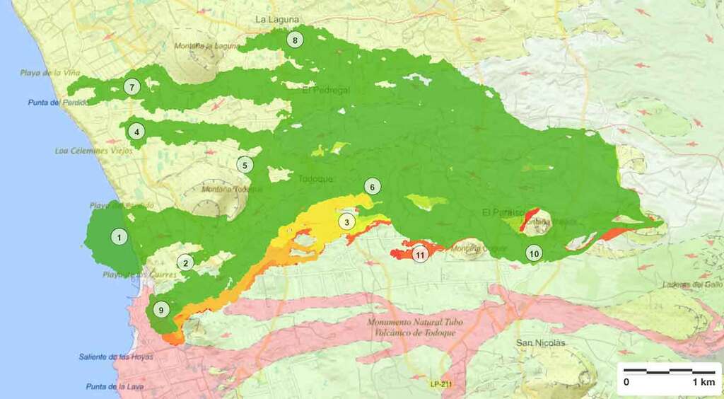
The latest lava flow map shows the recent progress of the lava flows mainly at the southern margin of the flow field, in particular the flow called number 11.
Southern lava flow threatens to cut off El Remo and Puerto de Naos
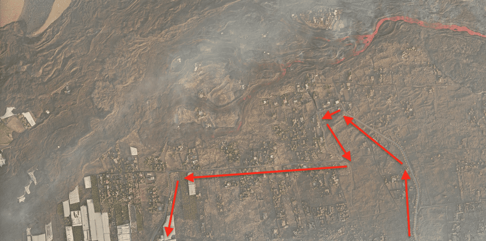
With lava effusion remaining high, most of it has been feeding the lava flows on the southern part of the flow field, in particular the ones named 3 and 9 on official maps.
The flow fronts yesterday were still in the Charcón area and had not reached the coast, but threaten to cut off the only remaining access road to El Remo and Puerto de Naos.According to a local news article, authorities are considering building an emergency new access road to allow trucks to access the threatened coastal areas in order to assist evacuation efforts.
In the meanwhile, further upslope on the southern margin, another flow front has detached near Cogote Mountain and forms another tongue that destroys new land areas so far “only” covered by thick (up to 1-2 meters) of ash fall.
11/02/2021 Alignment of higher emission centers, single shot with SOUND. La Palma IGME eruption
November 2, 2021
Emission centers aligned along the fissure. Strombolian emission of lava, gases and pyroclasts from the upper eruptive centers of the volcano. + info:spacer
Viewers – Geology, Lava Evolution and Earthquakes
These viewers are updated with the relevant information related to the event. In addition to the geological information, the Copernicus data are included with the delimitation of the lava and estimation of damage at different times (latest data at 11/01/21 18:50 UTC ), the delimitations of the lava offered by the Cabildo de La Palma (latest data on 11/02/21 1pm ) and the delimitation offered by the IGME ( 11/02/21 8:30 am ).
 |
 |
| I took the actual Lava Flow Map (Right) and enhanced it only slightly to help you see what I see. The NWO Octopus coming out of the sea and the LIZARD /REPTILE/ SATAN coming out of the land/Volcano. |  |
spacer
Started streaming 22 minutes ago; 11/1/21; 3:00 PM US Central Time
UPDATE: 11/02/2021; 1:50:50 PM
spacer
This was filmed lived this morning. Looks to me like the Volcano is still very active. The sky is very hazy though we are told it is a beautiful day in La Palma…the effects of the ash are still evident in this video. Air quality is pretty sketchy.
 Volcán Cumbre vieja LA PALMA
  Isla Bonita
spacer
The following snippets were taken from a video posted on TV MALAGA 24 Hour. The video does not specify when this video was shot. But it was posted today, Tuesday, November 2. I am thinking it was filmed yesterday. LOOK AT THE SKY!!! How can anyone breathe? Really, they should not be breathing that air. There will be many people developing health issues from the effects of this pollution. The air is NOT SAFE TO BREATHE! I don’t care what the “experts” or the “Government” tells you. AVOID THAT AIR LIKE THE PLAGUE!!
 News – The ash from the volcano engulfs the island of La Palma
Nov 2, 2021
 |
 |
 |
 |
 |
 |
spacer
UPDATE: 11/02/2021; 12:11:40 PM
spacer
Nov 2, 2021
spacer
Nov 2, 2021
spacer
Premiered 5 hours ago; 11/2/21 @ 7:00 AM US CENTRAL TIME


 152 earthquakes in 24 hours, 18 of those earthquakes felt by the population and a maximum of 4.6.
  The La Palma volcano has formed an ash cloud of 3,700 m. East direction.
  The ash expelled by the volcano increases and the air quality in the south of the island worsens
spacer
Nov 2, 2021
spacer
spacer

|
|
|
|
|
|
|
|
|
|
|
|
TO WATCH THE VIDEO: CLICK HERE Or CLICK HERE
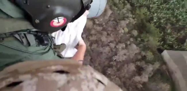
Lava flow from the Cumbre Vieja volcano’s continued eruptions made the largest cemetery on La Palma inaccessible for residents observing the Catholic feast of All Saints on Monday, November 1. Footage released by Spain’s Ministry of Defense shows personnel from the Spanish Air Force dropping flower petals over the Las Manchas Cemetery.The cemetery, which had been blanketed in ash by the volcano, was banked by a lava flow nearly 200 meters (approximately 656 feet) away, El Pais reported. Lava flow had destroyed 2,574 buildings across more than 975 hectares as of Sunday, according to the European Union’s Copernicus satellite program. Credit: Ministerio Defensa via Storyful
LA PALMA (Reuters) – Locals on the Spanish Canary Island of La Palma lit candles and laid flowers for their loved ones at a makeshift memorial on Monday, after the cemetery where they are buried was cut off by the lava flow from the Cumbre Vieja volcano.
Islanders, unable to visit the graves of family members in the Las Manchas cemetery of Los Angeles, gathered for an emotional tribute at a “memory corner” set up by the local government in the Plaza de Espana in nearby Los Llanos.
Nov. 1 is the Catholic feast of All Saints, a public holiday in Spain when people traditionally visit the graves of family members and lay flowers.
“I feel pain, we’re going through a lot of pain. We can’t go to the cemetery and take flowers to our loved ones,” said Tara, 27, who came to pay tribute to her parents.
The graves in the Las Manchas cemetery, which is closed because the surrounding lava makes it dangerous to access, did not go without flowers, however.
A military helicopter scattered flowers over the ash-covered area, while members of Spain’s Military Emergency Unit laid a floral tribute.
Since the eruption began on Sept. 19, lava from the volcano has covered nearly 900 hectares (2,200 acres) of land and destroyed more than 2,500 buildings.
More than 7,000 people have had to evacuate their homes, but no one has died in the eruption.
“We have nothing left, it’s all very sad. Please could this stop now … It has already destroyed our lives,” said Sagrario Castro, 45, whose parents are buried in the cemetery and whose brother has lost his house in the eruption.
The tribute brought comfort to some locals.
“It helps and gives you a spark of hope. We say that we can’t be there, but we are with them,” said local resident Monica.
(Writing by Jessica Jones; Editing by Aislinn Laing)
 |
 |
spacer
“4 CANARY DOGS OF LA PALMA – A Rapture Rescue Typology?”
‘Who Let the Saints Out?!’
By Luis Vega (31 Oct 2021)
vegapost@hotmail.com
www.PostScripts.org
‘For they themselves report what kind of welcome you gave us, and how you turned to God from idols to serve the living and true God 10and to await His Son from heaven, whom He raised from the dead— Jesus our deliverer from the coming wrath.’ –1 Thessalonians 1:9-10
So, People around the World have all been intrigued with La Palma Volcano and of its many mysterious Peromelia Apparitions. And others are also, who are Seeking, Collecting Data, Watching for possible Prophetic Nuances, specific to the Rapture event and timing. The events occurring in La Palma has been likened to a ‘Breaking of the Water’ in the Birthing Process. Its volcano eruption has been modeled Scientifically of being a possible cause for a great Tsunami Cataclysm.
And it has been alluded to how at a certain time, the Inhabitants of the Island will have to all ‘Depart’ or be Evacuated out entirely. This will come true if especially the conditions worsen and circumstances become unbearable for the People there to sustain. A peculiar event was unfolding and that was mentioned. It was about the 4 Stranded Dogs that were for sure to face Doom and Death in their ‘Red Sea Moment’, if not rescued. Worse, is that it appeared the Professional the local Government Authorities hesitated in making the effort to rescue them but only after much public outcry.
Then, when the effort was carried-out, they found suddenly, that the Dogs ‘Disappeared’, ‘in a moment’, overnight. Evidently, someone rescued the 4 Dogs and left evidence for such a feat; ‘that they were taken care of and are safe’. Was it ‘El Zorro’? So, now one may be reading too much into the story and how it is linked or can be with the Rapture event or Biblical Prophecy; a bit much regarding all this, as some or many would and do say…But as one was reading through a France 24 Article about the situation, one could not help but make some obvious mental associations that come across one’s mind. How so?
It is especially a correlation if one knows the circumstances of how the Rapture will occur, based on what is revealed in the Bible. It is or will be no different. Below is the link to the Article about the situation from the French News Source. But it is how they described it best that made one think of such a similar Rapture Rescue scenario. It deals with the Rapture event that is described by the Apostle Paul as being no difference in its outcome of how the Dogs ‘mysteriously disappeared overnight’. It will be no different and what will occur after the Rapture event for Jesus’ People. And as the 4 Dogs in question were Podencos or ‘Hounds’, it is a peculiar Breed.
A Rapture Rescue
Are such People of Jesus, those who are predisposed to being like a ‘Hound’, when it comes to Tracking Prophecy: Watching, Pursuing, Seeking Jesus’ return? Collecting Data about what is all happening on Earth presently that is fast becoming as dire as a slow moving ‘River of Lava’ like with La Palma Volcano? It is most certainly spelling Doom and Death to come to La Palma’s of the World. And Jesus’ People are Trapped and now facing their ‘Red Sea Moment’ with such things as losing their Jobs , Business, Education or Lives if not Injected with the COVID ‘Solution’?
To then have the next day after the Rapture event, the World’s People asking, ‘Where did they disappear to, so suddenly, overnight’? Who ‘Rescued’ or ‘Raptured them away from Earth to Safety from certain Doom and Death from their ‘Red Sea Moment’? A ‘Savior’. For sure, such a peculiar ‘Breed’ of People, Jesus has taken note of. Jesus came to rescue the Perishing from Sin and Satan. Jesus has concern and had pity enough to have resolve and do what the Earthly Powers-That-Be will not do nor have the resolve to rescue such ‘Canis’ or People.
And why these Motifs of Canines per chance? Obviously, the name of the Islands is the ‘Islands of the Dogs’. So, no more appropriate theme to go by. And what type of Dogs are these that ‘Disappeared’ overnight, snatched from the literal Fires of Hell? These special types of Dogs are Hounds, called Podencos. The word in Spanish means ‘Hounds’. They are most commonly bred for Hunters in Spain and Portugal. Now, the only deviation from the Dog Metaphor pertaining to the Rapture type is that the Dogs were desirable types, Hunters and bred as such.
In contrast, one would say that most ‘Dogs’, as a Metaphor of People that will be Rescued in the Rapture will be of all Types and Kinds, Breeds, etc. Even so, such would also fit the Rapture Metaphor one is comparing because it has not been the Highly Bred, or the Wealthy, the Powerful that normally seek the LORD nor have the need to be ‘Rescued’. They have all the means and resources, etc. So, one could not help but to transpose such qualities of who are those that in a similar way will be snatched-up in the Rapture event, overnight but the ‘Podencos’ of the LORD, no?
From Merriam Webster: Definition of hound ˈhau̇nd \
1-Dog.
2- A Dog of any of numerous Hunting Breeds including both Scent Hounds and Sight Hounds .
3- A Person who pursues like a Hound especially.
4- One who avidly Seeks or Collects something.
It is not to say that only those Followers of Jesus who are the Watcher ‘Dogs’ of Biblical Prophecy types that are avidly Seeking the LORD and Watching the Times and Season the End Times Signs or collecting Dates, that are exclusively to ‘Disappear’. But that in general, is it not true though that it is generally those that ‘Love His (Jesus’) Appearing that are the type that are actively Seeking, Collecting and Watching for the Rapture? And this, especially true that as for such, their ‘Red Sea Moment’ is closing in fast like the Lava Flow with the Dogs, no? One thought that it was an interesting perspective and angle at looking at what happened with these 4 Dogs of La Palma Volcano.
And how recently there has been much ‘Signaling’ about the Number 4 and how that is associated with the meaning of an ‘Open Door’ to be Rescued as one big ‘Exit Sign’ that are posted next to Doors, etc. The Dalet is the 4th Letter of the Hebrew Alefbet. The 4th Chapter of the book of Revelation is associated with the Door and the Bride of Christ being Raptured. Then the Name of YHVH appearing on the Door or Wall of Jerusalem, next to the Golden Gate, etc. And how that the 4 Dogs of La Palma mysteriously ‘Disappeared’ overnight, but with a Trace.
And that Trace is what, for the Believers after the Rapture event? It will be the Written Word, the many Bibles, Blogs, Posts, Articles, Charts, Letters, Texts left behind that perhaps millions of People around the World will pick-up and read of how it occurred; just as Jesus and the Apostles promised and described the Rapture event. So, as the title of the French Articles, stated, ‘Who Let the Dogs Out’? Or rather that one hopes it will shortly be broadcasted across the World as, ‘Who Let the Saints Out’?!
But as an addendum, a Blog member, Jimboni replied with the following statement that rings so true. To which I would only add that Our Scout, given the chance, would be quick to remind that ‘Caleb’ means ‘Dog’, and to which I rejoinder, as a Type of the Faithful Church awaiting The Master’s Call, Maranatha! And another Blog Member named Judi added the following observation. And is not the Holy Spirit called the Hound of Heaven, and are we not with Him hounds after Truth/the Word/Souls–Dogs with a Bone? And are we not as Gentiles, Dogs? Happy to feast on the Crumbs of the Master’s Table? But one day seated in full Honor and Glory at that very Table. Soon, Lord, Soon! Maranatha!!
Who Let the Dogs Out? Mystery Disappearance Grips Spain Volcano Isle
spacer
spacer

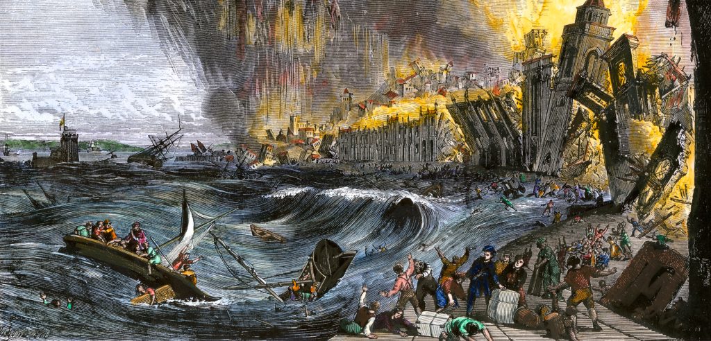
In seconds it left the city in ruins and in minutes those ruins were on fire. The earthquake probably killed about 90,000 – 100,000 people. Many of the survivors fled to the wharves and keys of Lisbon’s port, but they would find no safety there.
The first tsunami wave surged up the Tagus estuary about an hour after the earthquake, reached a maximum runup of 12 meters (40 feet), and killed another 1000 people. At least two more tsunami waves surged into the city, completing the earthquake’s destruction.
At Portugal’s coastal city of Lagos the tsunami was even larger, perhaps 30 m (100 ft). It went on to damage the ports of Cadiz in Spain, then Safi and Agadir in Morocco.
The tsunami also spread north: it caused minor damage at Brest in Brittany, some flooding in England in the Scilly Islands and in Cornwall, and extensively flooded of the low-lying areas of the city of Cork, Ireland.
As it spread out across the Atlantic, the tsunami first reached Madeira, where observers recorded a runup of 4 m (13 ft), then the Canary Islands, the Azores, and eventually the West Indies, where observers recorded runups of about a 1 m (3 ft) in Barbados, Martinique, Guadeloupe, and Antigua (and questionable reports of large runup in the Virgin Islands).
Though the tsunami must have hit Colonial America, no one recorded it there, though it was observed in Newfoundland.
The model of this tsunami assumes its source was a magnitude 8.5 earthquake on the Horseshoe Fault off of Cape Finisterre. Baptista, et al. (2011) explain how this fault matches the tsunami observations better than the several other proposed sources for the Great Lisbon Earthquake.
Similitudes with La Palma?
As you know, the Cumbre Vieja volcano is currently erupting on the island of la Palma in the Canary Islands, which are even closer to the American East Coast.
As demonstrated in various scientific publications, a slide from this mountain could kill millions of people in Europe and along Northern America’s eastern seaboard. Some eminent scientists warn that it’s purely a matter of time until it happens.
And this is how the tsunami wave would propagate:
spacer
MEGATSUNAMI SCENARIO
This is how the tsunami would develop:
- 2 Minutes: A 900 meters (3,000 ft) thick dome of water rises above the landslide.
- 5 Minutes: The dome collapses to a height of 500 meters (1,600 ft) as it advances by 50 kilometers (31 mi); additionally, wave valleys form.
- 10 Minutes: The landslide is now over. Waves reaching heights of 400–600 meters (1,300–2,000 ft) hit the three western Canary Islands.
- 15–60 Minutes: 50–100 meters (160–330 ft) high waves hit Africa. A 500 kilometers (310 mi) wide train of waves advances across the Atlantic.
- 3–6 Hours: The waves hit South America and Newfoundland, reaching heights of 15–20 meters (49–66 ft) and 10 meters (33 ft), respectively.
- Spain and England are partially protected by La Palma, thus tsunami waves there only reach 5–7 meters (16–23 ft).
- 9 Hours: Waves 20–25 meters (66–82 ft) approach Florida; they are not expected to grow farther as they hit the coast.
Even if you don’t believe the tsunami scenario will ever happen, just prepare yourself for the worse… Then you will feel safer!
spacer
UPDATE: 11/01/2021; 11:00:37 PM
spacer
IGN said the ash column towering above the volcano reached an altitude of 4.5 kilometers (15,000 feet) on Sunday before heavier wind scattered it. Many nearby towns and a telescope base further north that sits on a mountain at 2,400 meters above sea level (7,800 feet) were covered in a thick layer of ash.
It is estimated that around 66 cubic meters of lava per second are being erupted, an extremely high value for a volcanic flank eruption like the current one on La Palma. Source
Tourists are causing more problems for the locals who have lost everything:
Despite the eruption displacing island residents, tourists are flocking to La Palma to capture a glimpse of the volcanic fury. However, individuals who live on La Palma are frustrated with the influx of tourists when so many people had to evacuate and had their homes destroyed. Some hotels are completely shut down and only accommodating locals who needed to evacuate, per El País.
“They are coming with the simple aim of seeing the volcano,” Pablo Gonzáles, a hotel manager at Ashotel on the Canary Islands, explains to El País’sGuillermo Vega. “Now is not the moment for tourism for La Palma, it’s the time to help, and these people are not doing that and are instead occupying beds that could, for example, be used by the security forces.” Source
spacer
In the following video from our friend GutnTog, you will see people out on the street with their families, including children. I was shocked to see people letting their children play in the ash like it was a sand box. Sliding their hands and arms in and out of the ash and placing their faces very close, if not in the ash!!! Little children!!
Nov 1, 2021
Reporting from Mirador de Tajuya, La Palma on November 1, 2021. #LaPalma #CumbreVieja #CanaryIslandsspacer
I was so alarmed by what I saw in the above video that I went to look for information on the hazards of Volcanic Ash. I found a very helpful PDF. The link is on the Title below. I pray that parents will read it and pass it on to friends and family. It is not likely that the people who are foolishly exposing their children to these hazards will ever read my post… but I can pray that GOD gets them the information and gives them wisdom.
THE HEALTH HAZARDSOF VOLCANIC ASH (exerpts only)
A guide for the publicFreshly fallen ash particles can have acid coatings which may cause irritation to the lungs and eyes. This acid coating is rapidly removed by rain, which may then pollute local water supplies.
What are the effects of ash on health?
Effects of ash on health may be divided into several categories:
- respiratory effects,
- eye symptoms,
- skin irritation
- indirect effects.
Respiratory effects
In some eruptions, ash particles can be so fine that they are breathed deep into the lungs. With high exposure, even healthy individuals will experience chest discomfort with increased coughing and irritation. Common acute (short-term) symptoms include:
- Nasal irritation and discharge (runny nose).
- Throat irritation and sore throat, sometimes accompanied by dry coughing.
People with pre-existing chest complaints may develop severe bronchitic symptoms which last some days beyond exposure to ash (for example, hacking cough, production of sputum, wheezing, or shortness of breath).- Airway irritation for people with asthma or bronchitis; common complaints of people with asthma include: shortness of breath,
wheezing and coughing,
Breathing becomes uncomfortableWhat factors affect respiratory symptoms?
The development of respiratory symptoms from the inhalation of volcanic ash depends on a number of factors. These include the concentration of particles in the air, the proportion of fine particles in the ash, the frequency and duration of exposure, the presence of crystalline silica and volcanic gases or aerosols mixed with the ash, and meteorological conditions. Existing health conditions and the use of respiratory protective equipment will also influence the symptoms experienced.
Eye symptoms
Eye irritation is a common health effect as pieces of grit can cause painful scratches in the front of the eye (corneal
abrasions) and conjunctivitis. Contact lens wearers need to be especially aware of this problem and leave out their lenses to prevent corneal abrasion from occurring.Common symptoms include:
- Corneal abrasions or scratches.
- Acute conjunctivitis or the inflammation of the
conjunctival sac that surrounds the eyeball due to the
presence of ash, which leads to redness, burning of
the eyes, and photosensitivity.- Eyes feeling as though there are foreign particles in
them.- Eyes becoming painful, itchy or bloodshot.
- Sticky discharge or tearing.
Skin Irritation
While not common, volcanic ash can cause skin irritation for
some people, especially if the ash is acidic.
Symptoms include:
- Irritation and reddening of the skin.
- Secondary infections due to scratching.
Precautions for children
Children face the same hazards from the suspension of ash as other age groups, but their exposure may be increased because they are physically smaller and are less likely to adopt reasonable, prudent, preventive measures to avoid unnecessary exposure to ash. While evidence suggests that ingestion of small
amounts of ash is not hazardous, we recommend that you take the following precautions:
- Keep children indoors if possible.
- Children should beadvised against strenuous play or running when ash is in the air, since exertion leads to
heavier breathing, drawing small particles more deeply into the lungs.- Communities in heavy ashfall areas may wish to organize day-care programs to free parents for cleanup tasks.
- If children must be outdoors when ash is present in the air, they should wear a mask (preferably one approved by IVHHN). Many masks, however, are designed to fit adults rather than children.
Take particular care to prevent children playing in areas where ash is deep on the ground or piled up.
spacer
Nov 1, 2021
spacer
UPDATE: 11/01/2021; 6:34:02 PM
spacer
Nov 1, 2021; 7:00 PM
spacer
Nov 1, 2021
UPDATE: 11/01/2021; 12:15:08 PM
It is hard to get pics of the range from a distance. I often see what appears to me to be multiple plumes of smoke and/or steam coming from farther up the ridge. Take a look at this pic and see what you think. They are lesser plumes most often so they are hard to distinguish from clouds or from the trail of smoke from the Larger plume. But, in the right light you can spot them, whenever you are fortunate enough to see the longer range views. I have 22 pictures of a similar nature I have been collecting.

spacer
Nov 1, 2021
spacer
La Palma volcano “should be bombed” to divert lava flow
Talking about the flow, generally speaking there is little the emergency services can do to stop or divert the path of the lava and, in case you missed it, this led the president of the La Gomera Municipal Council, Casimiro Curbelo, to suggest a drastic strategy: using military aircraft to bomb the flows in an attempt to stop them in their tracks.
“Isn’t there a plane that can fly and drop… and send the lava in a different direction?” he said.
“Maybe its madness, but the technology today is much more reliable and I think it should be attempted. Although it is true it would have to fly at a reasonable altitude, but then it can get close and drop and… boom!” Curbelo reportedly said.
As Laura and Rob point out, there is a precedent for this solution. Click on the image above to read more.
spacer
 USGS Volcanoes
@USGSVolcanoes
In Feb 2020, #Hawaii media reported on a recent discovery of 2 ancient-looking bombs on the north flank of #MaunaLoa. The bombs were part of a 1935 effort to divert #lava and save #Hilo. Read about it in this week’s edition of #USGS #HVO’s #VolcanoWatch, http://ow.ly/6AlL50yEja1.
 |
Nov 1, 2021
spacer

spacer
 @LetUsUniteHere
|
spacer
Nov 1, 2021
Hello, I’m a Bushcraft Bear and share the latest information about the current volcanic eruption on the island of la palma in my videos. If you would like to support my YouTube channel, you are welcome to do so here:
Nov 1, 2021
spacer
LIVE 11/1/2021; 11:46:29 AM
UPDATE: 11/01/2021; 1:39:54 AM
spacer

OK FOLKS! It is time to take the possibility of the MegaTsunami scenario being a very real an immediate threat.
Will it happen? We don’t know for certain. When will it happen? We don’t know that either. The only thing that we can do is be watchful. Be alert and BE READY.
The Chart below shows all the reported/recorded earthquakes for this past weekend. Oct 30 & 31, and so far Nov 1. They are in alternate color type so you can clearly see the number of EQ per hour. This clearly demonstrates that the Volcanos are increasing in size/magnitude and in number/frequency.
As you know this is only one aspect of the volcanic event. There is Seismic activity, Smoke varieties, ash, lava, fire, noise, projectiles such as rocks, and movement of the earth, lifting, falling, cracking, shaking. Which are all increasing as well.
![]() Showing most recent quakes and quakes magnitude 3 or higher (513 out of 1105 quakes, show more): (it actually shows magnitude 2 or higher)
Showing most recent quakes and quakes magnitude 3 or higher (513 out of 1105 quakes, show more): (it actually shows magnitude 2 or higher)
Date and time |
Mag Depth |
Location |
| Monday, November 1, 2021 06:49 GMT (51 earthquakes) | ||
| Nov 1, 2021 6:49 am (GMT +0) (Nov 1, 2021 06:49 GMT) 48 minutes ago |
2.4
10 km |
La Palma Island, 13 km southeast of Los Llanos de Aridane, Spain |
| Nov 1, 2021 6:44 am (GMT +0) (Nov 1, 2021 06:44 GMT) 52 minutes ago |
2.7
12 km |
La Palma Island, 14 km southeast of Los Llanos de Aridane, Spain |
| Nov 1, 2021 6:41 am (GMT +0) (Nov 1, 2021 06:41 GMT) 56 minutes ago |
3.5
10 km |
La Palma Island, 13 km southeast of Los Llanos de Aridane, Spain I FELT IT |
| Nov 1, 2021 6:34 am (GMT +0) (Nov 1, 2021 06:34 GMT) 1 hour 3 minutes ago |
2.8
10 km |
La Palma Island, 14 km southeast of Los Llanos de Aridane, Spain |
| Nov 1, 2021 6:25 am (GMT +0) (Nov 1, 2021 06:25 GMT) 1 hour 11 minutes ago |
3.1
10 km |
La Palma Island, 13 km southeast of Los Llanos de Aridane, Spain I FELT IT |
| Nov 1, 2021 6:23 am (GMT +0) (Nov 1, 2021 06:23 GMT) 1 hour 14 minutes ago |
3.3
10 km |
La Palma Island, 13 km southeast of Los Llanos de Aridane, Spain I FELT IT |
| Nov 1, 2021 6:05 am (GMT +0) (Nov 1, 2021 06:05 GMT) 1 hour 32 minutes ago |
2.7
8 km |
La Palma Island, 13 km southeast of Los Llanos de Aridane, Spain I FELT IT |
| Nov 1, 2021 6:02 am (GMT +0) (Nov 1, 2021 06:02 GMT) 1 hour 34 minutes ago |
2.6
11 km |
La Palma Island, 13 km southeast of Los Llanos de Aridane, Spain |
| Nov 1, 2021 5:59 am (GMT +0) (Nov 1, 2021 05:59 GMT) 1 hour 37 minutes ago |
2.9
11 km |
La Palma Island, 14 km southeast of Los Llanos de Aridane, Spain |
| Nov 1, 2021 5:57 am (GMT +0) (Nov 1, 2021 05:57 GMT) 1 hour 39 minutes ago |
3.6
11 km |
La Palma Island, 13 km southeast of Los Llanos de Aridane, Spain I FELT IT – 1 report |
| Nov 1, 2021 5:54 am (GMT +0) (Nov 1, 2021 05:54 GMT) 1 hour 42 minutes ago |
2.7
11 km |
La Palma Island, 12 km southeast of Los Llanos de Aridane, Spain |
| Nov 1, 2021 5:51 am (GMT +0) (Nov 1, 2021 05:51 GMT) 1 hour 45 minutes ago |
3.0
13 km |
La Palma Island, 14 km southeast of Los Llanos de Aridane, Spain I FELT IT |
| Nov 1, 2021 5:50 am (GMT +0) (Nov 1, 2021 05:50 GMT) 1 hour 46 minutes ago |
2.9
10 km |
La Palma Island, 13 km southeast of Los Llanos de Aridane, Spain |
| Nov 1, 2021 5:46 am (GMT +0) (Nov 1, 2021 05:46 GMT) 1 hour 50 minutes ago |
3.3
20 km |
La Palma Island, 13 km southeast of Santa Cruz de La Palma, Spain I FELT IT – 1 report |
| Nov 1, 2021 5:43 am (GMT +0) (Nov 1, 2021 05:43 GMT) 1 hour 53 minutes ago |
2.6
11 km |
La Palma Island, 15 km southeast of Los Llanos de Aridane, Spain |
| Nov 1, 2021 5:40 am (GMT +0) (Nov 1, 2021 05:40 GMT) 1 hour 56 minutes ago |
2.9
11 km |
La Palma Island, 13 km southeast of Los Llanos de Aridane, Spain |
| Nov 1, 2021 5:36 am (GMT +0) (Nov 1, 2021 05:36 GMT) 2 hours 0 minutes ago |
2.4
10 km |
La Palma Island, 13 km southeast of Los Llanos de Aridane, Spain |
| Nov 1, 2021 5:34 am (GMT +0) (Nov 1, 2021 05:34 GMT) 2 hours 2 minutes ago |
2.6
10 km |
La Palma Island, 12 km southeast of Los Llanos de Aridane, Spain |
| Nov 1, 2021 5:23 am (GMT +0) (Nov 1, 2021 05:23 GMT) 2 hours 13 minutes ago |
2.6
11 km |
La Palma Island, 13 km southeast of Los Llanos de Aridane, Spain |
| Nov 1, 2021 5:22 am (GMT +0) (Nov 1, 2021 05:22 GMT) 2 hours 15 minutes ago |
3.2
11 km |
La Palma Island, 13 km southeast of Los Llanos de Aridane, Spain I FELT IT |
| Nov 1, 2021 5:12 am (GMT +0) (Nov 1, 2021 05:12 GMT) 2 hours 24 minutes ago |
3.0
11 km |
La Palma Island, 14 km southeast of Los Llanos de Aridane, Spain I FELT IT – 1 report |
| Nov 1, 2021 5:10 am (GMT +0) (Nov 1, 2021 05:10 GMT) 2 hours 27 minutes ago |
2.4
10 km |
La Palma Island, 11 km southeast of Los Llanos de Aridane, Spain |
| Nov 1, 2021 5:08 am (GMT +0) (Nov 1, 2021 05:08 GMT) 2 hours 29 minutes ago |
2.9
11 km |
La Palma Island, 14 km southeast of Los Llanos de Aridane, Spain |
| Nov 1, 2021 4:56 am (GMT +0) (Nov 1, 2021 04:56 GMT) 2 hours 40 minutes ago |
3.0
36 km |
La Palma Island, 4 km southwest of Santa Cruz de La Palma, Spain I FELT IT |
| Nov 1, 2021 4:55 am (GMT +0) (Nov 1, 2021 04:55 GMT) 2 hours 41 minutes ago |
2.7
10 km |
La Palma Island, 14 km southeast of Los Llanos de Aridane, Spain |
| Nov 1, 2021 4:53 am (GMT +0) (Nov 1, 2021 04:53 GMT) 2 hours 44 minutes ago |
2.5
10 km |
La Palma Island, 13 km southeast of Los Llanos de Aridane, Spain |
| Nov 1, 2021 4:36 am (GMT +0) (Nov 1, 2021 04:36 GMT) 3 hours 0 minutes ago |
2.7
10 km |
La Palma Island, 14 km southeast of Los Llanos de Aridane, Spain |
| Nov 1, 2021 4:21 am (GMT +0) (Nov 1, 2021 04:21 GMT) 3 hours 15 minutes ago |
3.0
11 km |
La Palma Island, 15 km southeast of Los Llanos de Aridane, Spain I FELT IT |
| Nov 1, 2021 4:12 am (GMT +0) (Nov 1, 2021 04:12 GMT) 3 hours 24 minutes ago |
3.0
10 km |
La Palma Island, 13 km southeast of Los Llanos de Aridane, Spain I FELT IT |
| Nov 1, 2021 4:03 am (GMT +0) (Nov 1, 2021 04:03 GMT) 3 hours 33 minutes ago |
3.2
14 km |
La Palma Island, 14 km southeast of Los Llanos de Aridane, Spain I FELT IT |
| Nov 1, 2021 4:00 am (GMT +0) (Nov 1, 2021 04:00 GMT) 3 hours 36 minutes ago |
3.6
12 km |
La Palma Island, 13 km southeast of Los Llanos de Aridane, Spain I FELT IT – 1 report |
| Nov 1, 2021 3:53 am (GMT +0) (Nov 1, 2021 03:53 GMT) 3 hours 43 minutes ago |
3.2
11 km |
La Palma Island, 13 km southeast of Los Llanos de Aridane, Spain I FELT IT – 2 reports |
| Nov 1, 2021 3:41 am (GMT +0) (Nov 1, 2021 03:41 GMT) 3 hours 56 minutes ago |
3.1
13 km |
La Palma Island, 13 km southeast of Los Llanos de Aridane, Spain I FELT IT |
| Nov 1, 2021 3:36 am (GMT +0) (Nov 1, 2021 03:36 GMT) 4 hours ago |
2.8
10 km |
La Palma Island, 13 km southeast of Los Llanos de Aridane, Spain |
| Nov 1, 2021 3:34 am (GMT +0) (Nov 1, 2021 03:34 GMT) 4 hours ago |
3.4
14 km |
La Palma Island, 15 km southeast of Los Llanos de Aridane, Spain I FELT IT |
| Nov 1, 2021 3:28 am (GMT +0) (Nov 1, 2021 03:28 GMT) 4 hours ago |
3.2
11 km |
La Palma Island, 13 km southeast of Los Llanos de Aridane, Spain I FELT IT |
| Nov 1, 2021 3:26 am (GMT +0) (Nov 1, 2021 03:26 GMT) 4 hours ago |
2.8
14 km |
La Palma Island, 13 km southeast of Los Llanos de Aridane, Spain |
| Nov 1, 2021 3:00 am (GMT +0) (Nov 1, 2021 03:00 GMT) 5 hours ago |
3.4
11 km |
La Palma Island, 13 km southeast of Los Llanos de Aridane, Spain I FELT IT |
| Nov 1, 2021 2:56 am (GMT +0) (Nov 1, 2021 02:56 GMT) 5 hours ago |
2.6
10 km |
La Palma Island, 12 km southeast of Los Llanos de Aridane, Spain |
| Nov 1, 2021 2:44 am (GMT +0) (Nov 1, 2021 02:44 GMT) 5 hours ago |
3.6
11 km |
La Palma Island, 13 km southeast of Los Llanos de Aridane, Spain I FELT IT – 3 reports |
| Nov 1, 2021 2:39 am (GMT +0) (Nov 1, 2021 02:39 GMT) 5 hours ago |
3.0
32 km |
La Palma Island, 9.3 km south of Santa Cruz de La Palma, Spain I FELT IT |
| Nov 1, 2021 2:36 am (GMT +0) (Nov 1, 2021 02:36 GMT) 5 hours ago |
2.8
12 km |
La Palma Island, 13 km southeast of Los Llanos de Aridane, Spain |
| Nov 1, 2021 2:27 am (GMT +0) (Nov 1, 2021 02:27 GMT) 5 hours ago |
2.7
10 km |
La Palma Island, 13 km southeast of Los Llanos de Aridane, Spain |
| Nov 1, 2021 2:17 am (GMT +0) (Nov 1, 2021 02:17 GMT) 5 hours ago |
2.9
11 km |
La Palma Island, 13 km southeast of Los Llanos de Aridane, Spain |
| Nov 1, 2021 2:15 am (GMT +0) (Nov 1, 2021 02:15 GMT) 5 hours ago |
2.6
10 km |
La Palma Island, 14 km southeast of Los Llanos de Aridane, Spain |
| Nov 1, 2021 1:57 am (GMT +0) (Nov 1, 2021 01:57 GMT) 6 hours ago |
3.5
11 km |
La Palma Island, 13 km southeast of Los Llanos de Aridane, Spain I FELT IT |
| Nov 1, 2021 1:53 am (GMT +0) (Nov 1, 2021 01:53 GMT) 6 hours ago |
2.6
14 km |
La Palma Island, 16 km southeast of Los Llanos de Aridane, Spain |
| Nov 1, 2021 1:31 am (GMT +0) (Nov 1, 2021 01:31 GMT) 6 hours ago |
3.2
11 km |
La Palma Island, 13 km southeast of Los Llanos de Aridane, Spain I FELT IT |
| Nov 1, 2021 1:22 am (GMT +0) (Nov 1, 2021 01:22 GMT) 6 hours ago |
3.3
11 km |
La Palma Island, 13 km southeast of Los Llanos de Aridane, Spain I FELT IT |
| Nov 1, 2021 12:21 am (GMT +0) (Nov 1, 2021 00:21 GMT) 7 hours ago |
3.0
32 km |
La Palma Island, 17 km southeast of Los Llanos de Aridane, Spain I FELT IT – 1 report |
| Nov 1, 2021 12:15 am (GMT +0) (Nov 1, 2021 00:15 GMT) 7 hours ago |
2.8
10 km |
La Palma Island, 14 km southeast of Los Llanos de Aridane, Spain |
| Sunday, October 31, 2021 23:48 GMT (32 earthquakes) | ||
| Oct 31, 2021 11:48 pm (GMT +0) (Oct 31, 2021 23:48 GMT) 8 hours ago |
3.3
35 km |
La Palma Island, 8.8 km south of Santa Cruz de La Palma, Spain I FELT IT – 1 report |
| Oct 31, 2021 11:43 pm (GMT +0) (Oct 31, 2021 23:43 GMT) 8 hours ago |
2.4
9 km |
La Palma Island, 14 km southeast of Los Llanos de Aridane, Spain |
| Oct 31, 2021 11:36 pm (GMT +0) (Oct 31, 2021 23:36 GMT) 8 hours ago |
2.8
10 km |
La Palma Island, 13 km southeast of Los Llanos de Aridane, Spain |
| Oct 31, 2021 11:04 pm (GMT +0) (Oct 31, 2021 23:04 GMT) 9 hours ago |
3.2
38 km |
La Palma Island, 14 km southeast of Los Llanos de Aridane, Spain I FELT IT |
| Oct 31, 2021 9:11 pm (GMT +0) (Oct 31, 2021 21:11 GMT) 10 hours ago |
3.3
13 km |
La Palma Island, 13 km southeast of Los Llanos de Aridane, Spain I FELT IT – 1 report |
| Oct 31, 2021 6:53 pm (GMT +0) (Oct 31, 2021 18:53 GMT) 13 hours ago |
3.1
9 km |
La Palma Island, 14 km southeast of Los Llanos de Aridane, Spain I FELT IT – 1 report |
| Oct 31, 2021 6:41 pm (GMT +0) (Oct 31, 2021 18:41 GMT) 13 hours ago |
3.1
11 km |
La Palma Island, 12 km southeast of Los Llanos de Aridane, Spain I FELT IT |
| Oct 31, 2021 6:32 pm (GMT +0) (Oct 31, 2021 18:32 GMT) 13 hours ago |
3.0
10 km |
La Palma Island, 14 km southeast of Los Llanos de Aridane, Spain I FELT IT |
| Oct 31, 2021 6:18 pm (GMT +0) (Oct 31, 2021 18:18 GMT) 13 hours ago |
3.3
10 km |
La Palma Island, 11 km southeast of Los Llanos de Aridane, Spain I FELT IT |
| Oct 31, 2021 5:52 pm (GMT +0) (Oct 31, 2021 17:52 GMT) 14 hours ago |
5.0
38 km |
La Palma Island, 17 km southeast of Los Llanos de Aridane, Spain I FELT IT – 95 reports |
| Oct 31, 2021 4:45 pm (GMT +0) (Oct 31, 2021 16:45 GMT) 15 hours ago |
3.0
10 km |
La Palma Island, 13 km southeast of Los Llanos de Aridane, Spain I FELT IT |
| Oct 31, 2021 4:43 pm (GMT +0) (Oct 31, 2021 16:43 GMT) 15 hours ago |
3.0
15 km |
La Palma Island, 17 km southeast of Los Llanos de Aridane, Spain I FELT IT |
| Oct 31, 2021 4:36 pm (GMT +0) (Oct 31, 2021 16:36 GMT) 15 hours ago |
3.0
8 km |
La Palma Island, 12 km southeast of Los Llanos de Aridane, Spain I FELT IT – 1 report |
| Oct 31, 2021 3:09 pm (GMT +0) (Oct 31, 2021 15:09 GMT) 16 hours ago |
3.2
11 km |
La Palma Island, 12 km southeast of Los Llanos de Aridane, Spain I FELT IT |
| Oct 31, 2021 2:43 pm (GMT +0) (Oct 31, 2021 14:43 GMT) 17 hours ago |
3.1
10 km |
La Palma Island, 12 km south of Los Llanos de Aridane, Spain I FELT IT |
| Oct 31, 2021 1:57 pm (GMT +0) (Oct 31, 2021 13:57 GMT) 18 hours ago |
3.4
10 km |
La Palma Island, 13 km southeast of Los Llanos de Aridane, Spain I FELT IT – 2 reports |
| Oct 31, 2021 1:41 pm (GMT +0) (Oct 31, 2021 13:41 GMT) 18 hours ago |
3.0
9 km |
La Palma Island, 13 km southeast of Los Llanos de Aridane, Spain I FELT IT |
| Oct 31, 2021 11:12 am (GMT +0) (Oct 31, 2021 11:12 GMT) 20 hours ago |
3.1
11 km |
La Palma Island, 13 km southeast of Los Llanos de Aridane, Spain I FELT IT |
| Oct 31, 2021 10:48 am (GMT +0) (Oct 31, 2021 10:48 GMT) 21 hours ago |
3.0
12 km |
La Palma Island, 15 km southeast of Los Llanos de Aridane, Spain I FELT IT |
| Oct 31, 2021 10:28 am (GMT +0) (Oct 31, 2021 10:28 GMT) 21 hours ago |
3.1
12 km |
La Palma Island, 14 km southeast of Los Llanos de Aridane, Spain I FELT IT |
| Oct 31, 2021 9:35 am (GMT +0) (Oct 31, 2021 09:35 GMT) 22 hours ago |
3.4
13 km |
La Palma Island, 12 km southeast of Los Llanos de Aridane, Spain I FELT IT |
| Oct 31, 2021 9:20 am (GMT +0) (Oct 31, 2021 09:20 GMT) 22 hours ago |
3.1
11 km |
La Palma Island, 13 km southeast of Los Llanos de Aridane, Spain I FELT IT |
| Oct 31, 2021 9:11 am (GMT +0) (Oct 31, 2021 09:11 GMT) 22 hours ago |
3.3
11 km |
La Palma Island, 14 km southeast of Los Llanos de Aridane, Spain I FELT IT |
| Oct 31, 2021 8:35 am (GMT +0) (Oct 31, 2021 08:35 GMT) 23 hours ago |
3.4
12 km |
La Palma Island, 14 km southeast of Los Llanos de Aridane, Spain I FELT IT |
| Oct 31, 2021 7:44 am (GMT +0) (Oct 31, 2021 07:44 GMT) 24 hours ago |
3.0
11 km |
La Palma Island, 13 km southeast of Los Llanos de Aridane, Spain I FELT IT |
| Oct 31, 2021 7:12 am (GMT +0) (Oct 31, 2021 07:12 GMT) 1 day 0 hours ago |
3.2
13 km |
La Palma Island, 15 km southeast of Los Llanos de Aridane, Spain I FELT IT |
| Oct 31, 2021 6:52 am (GMT +0) (Oct 31, 2021 06:52 GMT) 1 day 1 hours ago |
3.1
12 km |
La Palma Island, 14 km southeast of Los Llanos de Aridane, Spain I FELT IT |
| Oct 31, 2021 3:59 am (GMT +0) (Oct 31, 2021 03:59 GMT) 1 day 4 hours ago |
3.1
14 km |
La Palma Island, 14 km southeast of Los Llanos de Aridane, Spain I FELT IT – 1 report |
| Oct 31, 2021 3:54 am (GMT +0) (Oct 31, 2021 03:54 GMT) 1 day 4 hours ago |
3.3
35 km |
La Palma Island, 14 km southeast of Los Llanos de Aridane, Spain I FELT IT |
| Oct 31, 2021 3:27 am (GMT +0) (Oct 31, 2021 03:27 GMT) 1 day 4 hours ago |
3.1
14 km |
La Palma Island, 14 km southeast of Los Llanos de Aridane, Spain I FELT IT |
| Oct 31, 2021 1:46 am (GMT +1) (Oct 31, 2021 00:46 GMT) 1 day 7 hours ago |
3.1
13 km |
La Palma Island, 14 km southeast of Los Llanos de Aridane, Spain I FELT IT – 1 report |
| Oct 31, 2021 1:34 am (GMT +1) (Oct 31, 2021 00:34 GMT) 1 day 7 hours ago |
3.0
15 km |
La Palma Island, 14 km southeast of Los Llanos de Aridane, Spain I FELT IT |
| Saturday, October 30, 2021 22:47 GMT (41 earthquakes) | ||
| Oct 30, 2021 11:47 pm (GMT +1) (Oct 30, 2021 22:47 GMT) 1 day 9 hours ago |
3.0
11 km |
La Palma Island, 14 km southeast of Los Llanos de Aridane, Spain I FELT IT |
| Oct 30, 2021 11:24 pm (GMT +1) (Oct 30, 2021 22:24 GMT) 1 day 9 hours ago |
3.4
14 km |
La Palma Island, 14 km southeast of Los Llanos de Aridane, Spain I FELT IT |
| Oct 30, 2021 10:03 pm (GMT +1) (Oct 30, 2021 21:03 GMT) 1 day 11 hours ago |
3.2
13 km |
La Palma Island, 14 km southeast of Los Llanos de Aridane, Spain I FELT IT |
| Oct 30, 2021 9:55 pm (GMT +1) (Oct 30, 2021 20:55 GMT) 1 day 11 hours ago |
3.0
15 km |
La Palma Island, 13 km southeast of Los Llanos de Aridane, Spain I FELT IT – 1 report |
| Oct 30, 2021 9:52 pm (GMT +1) (Oct 30, 2021 20:52 GMT) 1 day 11 hours ago |
3.0
36 km |
La Palma Island, 18 km southeast of Los Llanos de Aridane, Spain I FELT IT |
| Oct 30, 2021 8:47 pm (GMT +1) (Oct 30, 2021 19:47 GMT) 1 day 12 hours ago |
3.2
14 km |
La Palma Island, 14 km southeast of Los Llanos de Aridane, Spain I FELT IT – 1 report |
| Oct 30, 2021 8:11 pm (GMT +1) (Oct 30, 2021 19:11 GMT) 1 day 12 hours ago |
3.0
36 km |
La Palma Island, 13 km south of Santa Cruz de La Palma, Spain I FELT IT |
| Oct 30, 2021 7:40 pm (GMT +1) (Oct 30, 2021 18:40 GMT) 1 day 13 hours ago |
3.1
13 km |
La Palma Island, 14 km southeast of Los Llanos de Aridane, Spain I FELT IT |
| Oct 30, 2021 5:52 pm (GMT +1) (Oct 30, 2021 16:52 GMT) 1 day 15 hours ago |
3.1
12 km |
La Palma Island, 13 km southeast of Los Llanos de Aridane, Spain I FELT IT |
| Oct 30, 2021 5:25 pm (GMT +1) (Oct 30, 2021 16:25 GMT) 1 day 15 hours ago |
3.0
10 km |
La Palma Island, 14 km southeast of Los Llanos de Aridane, Spain I FELT IT |
| Oct 30, 2021 4:39 pm (GMT +1) (Oct 30, 2021 15:39 GMT) 1 day 16 hours ago |
3.0
14 km |
La Palma Island, 13 km southeast of Los Llanos de Aridane, Spain I FELT IT |
| Oct 30, 2021 4:36 am (GMT +1) (Oct 30, 2021 03:36 GMT) 2 days ago |
4.1
37 km |
La Palma Island, 13 km southeast of Los Llanos de Aridane, Spain I FELT IT – 10 reports |
| Oct 30, 2021 3:55 pm (GMT +1) (Oct 30, 2021 14:55 GMT) 1 day 17 hours ago |
3.0
14 km |
La Palma Island, 13 km southeast of Los Llanos de Aridane, Spain I FELT IT |
| Oct 30, 2021 2:39 pm (GMT +1) (Oct 30, 2021 13:39 GMT) 1 day 18 hours ago |
3.5
13 km |
La Palma Island, 14 km southeast of Los Llanos de Aridane, Spain I FELT IT – 9 reports |
| Oct 30, 2021 2:17 pm (GMT +1) (Oct 30, 2021 13:17 GMT) 1 day 18 hours ago |
3.1
11 km |
La Palma Island, 13 km southeast of Los Llanos de Aridane, Spain I FELT IT – 1 report |
| Oct 30, 2021 1:14 pm (GMT +1) (Oct 30, 2021 12:14 GMT) 1 day 19 hours ago |
3.0
12 km |
La Palma Island, 14 km southeast of Los Llanos de Aridane, Spain I FELT IT |
| Oct 30, 2021 12:44 pm (GMT +1) (Oct 30, 2021 11:44 GMT) 1 day 20 hours ago |
3.1
15 km |
La Palma Island, 14 km southeast of Los Llanos de Aridane, Spain I FELT IT |
| Oct 30, 2021 12:37 pm (GMT +1) (Oct 30, 2021 11:37 GMT) 1 day 20 hours ago |
3.2
10 km |
La Palma Island, 13 km southeast of Los Llanos de Aridane, Spain I FELT IT |
| Oct 30, 2021 12:08 pm (GMT +1) (Oct 30, 2021 11:08 GMT) 1 day 20 hours ago |
3.1
11 km |
La Palma Island, 13 km southeast of Los Llanos de Aridane, Spain I FELT IT – 1 report |
| Oct 30, 2021 11:01 am (GMT +1) (Oct 30, 2021 10:01 GMT) 1 day 22 hours ago |
3.1
11 km |
La Palma Island, 12 km southeast of Los Llanos de Aridane, Spain I FELT IT |
| Oct 30, 2021 10:23 am (GMT +1) (Oct 30, 2021 09:23 GMT) 1 day 22 hours ago |
3.0
11 km |
La Palma Island, 12 km southeast of Los Llanos de Aridane, Spain I FELT IT |
| Oct 30, 2021 9:49 am (GMT +1) (Oct 30, 2021 08:49 GMT) 1 day 23 hours ago |
3.0
10 km |
La Palma Island, 15 km southeast of Los Llanos de Aridane, Spain I FELT IT |
| Oct 30, 2021 9:25 am (GMT +1) (Oct 30, 2021 08:25 GMT) 1 day 23 hours ago |
3.0
10 km |
La Palma Island, 14 km southeast of Los Llanos de Aridane, Spain I FELT IT |
| Oct 30, 2021 8:33 am (GMT +1) (Oct 30, 2021 07:33 GMT) 2 days ago |
3.0
10 km |
La Palma Island, 14 km southeast of Los Llanos de Aridane, Spain I FELT IT |
| Oct 30, 2021 8:16 am (GMT +1) (Oct 30, 2021 07:16 GMT) 2 days ago |
3.1
11 km |
La Palma Island, 12 km southeast of Los Llanos de Aridane, Spain I FELT IT |
| Oct 30, 2021 7:59 am (GMT +1) (Oct 30, 2021 06:59 GMT) 2 days ago |
3.1
11 km |
La Palma Island, 14 km southeast of Los Llanos de Aridane, Spain I FELT IT |
| Oct 30, 2021 7:24 am (GMT +1) (Oct 30, 2021 06:24 GMT) 2 days ago |
5.0
35 km |
La Palma Island, 15 km southwest of Santa Cruz de La Palma, Spain I FELT IT – 162 reports |
| Oct 30, 2021 7:21 am (GMT +1) (Oct 30, 2021 06:21 GMT) 2 days ago |
3.3
10 km |
La Palma Island, 13 km southeast of Los Llanos de Aridane, Spain I FELT IT – 15 reports |
| Oct 30, 2021 7:13 am (GMT +1) (Oct 30, 2021 06:13 GMT) 2 days ago |
3.7
10 km |
La Palma Island, 12 km southeast of Los Llanos de Aridane, Spain I FELT IT – 10 reports |
| Oct 30, 2021 6:46 am (GMT +1) (Oct 30, 2021 05:46 GMT) 2 days ago |
3.0
10 km |
La Palma Island, 12 km southeast of Los Llanos de Aridane, Spain I FELT IT |
| Oct 30, 2021 6:38 am (GMT +1) (Oct 30, 2021 05:38 GMT) 2 days ago |
3.2
12 km |
La Palma Island, 13 km southeast of Los Llanos de Aridane, Spain I FELT IT – 2 reports |
| Oct 30, 2021 6:16 am (GMT +1) (Oct 30, 2021 05:16 GMT) 2 days ago |
3.2
12 km |
La Palma Island, 13 km southeast of Los Llanos de Aridane, Spain I FELT IT – 1 report |
| Oct 30, 2021 5:32 am (GMT +1) (Oct 30, 2021 04:32 GMT) 2 days ago |
3.0
11 km |
La Palma Island, 13 km southeast of Los Llanos de Aridane, Spain I FELT IT |
| Oct 30, 2021 4:36 am (GMT +1) (Oct 30, 2021 03:36 GMT) 2 days ago |
4.1
37 km |
La Palma Island, 13 km southeast of Los Llanos de Aridane, Spain I FELT IT – 10 reports |
| Oct 30, 2021 4:17 am (GMT +1) (Oct 30, 2021 03:17 GMT) 2 days ago |
3.5
14 km |
La Palma Island, 14 km southeast of Los Llanos de Aridane, Spain I FELT IT |
| Oct 30, 2021 3:54 am (GMT +1) (Oct 30, 2021 02:54 GMT) 2 days ago |
3.4
14 km |
La Palma Island, 14 km southeast of Los Llanos de Aridane, Spain I FELT IT |
| Oct 30, 2021 3:46 am (GMT +1) (Oct 30, 2021 02:46 GMT) 2 days ago |
3.0
12 km |
La Palma Island, 13 km southeast of Los Llanos de Aridane, Spain I FELT IT |
| Oct 30, 2021 3:30 am (GMT +1) (Oct 30, 2021 02:30 GMT) 2 days ago |
3.2
14 km |
La Palma Island, 14 km southeast of Los Llanos de Aridane, Spain I FELT IT – 1 report |
| Oct 30, 2021 3:28 am (GMT +1) (Oct 30, 2021 02:28 GMT) 2 days ago |
3.3
12 km |
La Palma Island, 14 km southeast of Los Llanos de Aridane, Spain I FELT IT |
| Oct 30, 2021 2:10 am (GMT +1) (Oct 30, 2021 01:10 GMT) 2 days ago |
3.0
14 km |
La Palma Island, 14 km southeast of Los Llanos de Aridane, Spain I FELT IT |
| Oct 30, 2021 2:02 am (GMT +1) (Oct 30, 2021 01:02 GMT) 2 days ago |
3.0
10 km |
La Palma Island, 13 km southeast of Los Llanos de Aridane, Spain I FELT IT |
| Oct 30, 2021 1:51 am (GMT +1) (Oct 30, 2021 00:51 GMT) 2 days ago |
3.2
13 km |
La Palma Island, 14 km southeast of Los Llanos de Aridane, Spain I FELT IT |
| Friday, October 29, 2021 23:55 GMT (67 earthquakes) | ||
| Oct 30, 2021 12:55 am (GMT +1) (Oct 29, 2021 23:55 GMT) 2 days ago |
3.0
13 km |
La Palma Island, 14 km southeast of Los Llanos de Aridane, Spain I FELT IT |
| Oct 30, 2021 12:39 am (GMT +1) (Oct 29, 2021 23:39 GMT) 2 days ago |
3.0
14 km |
La Palma Island, 12 km southeast of Los Llanos de Aridane, Spain I FELT IT |
| Oct 30, 2021 12:11 am (GMT +1) (Oct 29, 2021 23:11 GMT) 2 days ago |
3.1
13 km |
La Palma Island, 14 km southeast of Los Llanos de Aridane, Spain I FELT IT |
EXERPT FROM HAL TURNER UPDATE 8:47 PM EDT — 10/31/21
More information has come in from a Geologist working with a government; I won’t say which government.
This Geologist pointed out that today, the island of LaPalma suffered another Magnitude 5.0 earthquake. In and of itself, that does not seem odd except for this:
Yesterday, for the first time in fifty years, LaPalma had a Magnitude 5.0 earthquake. First time in fifty years. Strongest quake in 50 years.
Here we are, a mere 24 hours later, and LaPalma had . . . . another 5.0 quake:
The Geologist said that it took weeks for enough magma to move, in order that LaPalma could have the 5.0 quake YESTERDAY. He pointed out that now, only 24 hours later, enough magma has already moved to give the island yet another 5.0 quake.
While the Geologist admits this could just be coincidental, he ALSO pointed out that the rush of magma from deep within the earth, could now be so voluminous underground, that it was magma which caused the second 5.0 quake today . . . . and if that much magma is now moving, HE SAYS – and he qualifies this as a highly unlikely possibility — the amount of magma on the move couldcause the island of LaPalma to actually explode within 48 hours.
The geologist points to the public earthquake location data to reiterate his thinking.
He then drew a line to show where those quakes __could__ continue moving within the next 48 hours, to back up his belief the island could explode from the magma already coming up in such volume as to cause todays’ second Magnitude 5.0 in a mere 24 hours. Here’s his line:

He went on to say that “if that much magma is coming up that fast, the island will simply burst as it makes the surface.” He told me to watch for vast ground deformation (inflation) over widespread and new areas. He says “that will be the sign that the island is lost.”
Finally, he pointed out that the Canary Islands government volcano web site, is showing Harmonic Tremors, which he says is caused by Magma movement, “higher tonight than any time in the last 6 weeks” which, he says “shows a gigantic burst of magma is heading toward the surface.”
Streamed live 100 minutes ago; 11/1/21; 1:30 PM US CENTRAL TIME
spacer

spacer
Premiered 2 hours ago; 10/31/21
 Last minute of the volcano of La Palma, live Last minute of the volcano of La Palma, live the latest news from the volcano cumbre vieja in La Palma, The increase in the emission of fluid lava increases the height of the lava flows. #news #last News #volcanlapalma #lapalma
spacer
Oct 31, 2021
acer
UPDATE: 10/31/2021; 11:40:55 PM
spacer
spacer
Oct 31, 2021
spacer
2021-10-31 Quake News & Updates
WATCHES & WARNINGS: imminent threats for large earthquakes or tsunami • A WATCH remains in effect for the island of La Palma in the Canary Islands for a potential M6.4-7.7+ quake and possible violent blow-out eruption of the volcano there. This is not a prediction, only a WATCH because of the possibility of such an event occurring. We are watching a fast-progressing number of quakes ramping up, which ay lead to a much larger event relatively soon. The highest magnitude thus far has been a M5.1 quake which occurred on Saturday.
La Palma Eruption Update:
Following yesterday’s high of M5.1, earthquakes have been fewer in number today, reaching a high of M4.6. The earthquakes are getting shallower – closer to the surface – which is always a concern.
The last two days, the volcano has put out a tremendous amount of smoke and ash. Black ash covers the streets and roads 2 inches or more in depth across many parts of the island just in the past two days. While ashfall has been a constant issue since the volcano first erupted, the amount of ashfall the last two days has been very heavy and is accumulating. Roofs will cave in where they have not been swept clean. Air quality the last two days has been very poor as you would expect, and visibility has been low. Volcanic lightning is increasing above the
main vent.
Because it is a holiday, i.e. Halloween, there have been hundreds of revelers arrive to party on the island as well as hundreds of tourists to watch the volcano. Trick or treaters are trudging through the ash-covered streets tonight to get their candy, seemingly oblivious to the loud and scary sounds of a roaring volcano that is now erupting and destroying part of the town where they are partying. To risk one’s life to party below a potentially lethal volcano
while it is erupting is hard to imagine. It is a fool’s paradise, I guess.
We are watching for a larger and more lethal eruptive event to occur on La Palma within a relatively short time. It’s not anywhere near being over yet.
See the current issue of the
spacer
Started streaming 3 hours ago
 Today Eruption Times for today @ 13:00:00 GMT, 17:00:00 GMT, Between 10.31.2021 -11.1.202 expect a 5.0 + mg for La Palma, Spain because of 2017-TS3’s Large Diameter and High Angular Velocity and Rotational Velocities and Distance of 3,334,000 Miles. Between 11.1.2021 -11.14.2021 Expect a 7.0+ mg for La Palma, Spain November 11.9.2021 7.0+ ) Strong Eruption and High Magnitude because of 2019-XS close Distance of 334,000 Miles to the Surface of the Earth and its high Angular and Rotational Velocities. Earthquake ; Eruption GMT Times 10.31.2021- High Magnitude Earthquake Warning La Palma, Spain
  Today Eruption Times ☆ 2017-TS3 11.1.2021 La Palma, Spain Strong Eruption and High Magnitude Earthquake at 18:00:00–22:00:00 GMT 2017-TS3 ☆2019-RU3: 3,560 Feet 80,893 A.Vel R.Vel 69,583 8.0+ mg Expected -High Magnitude Earthquake & Eruption Date & GMT Times For La Palma, Spain
  ☆2019-XS 11.3.2021-11.9.2021, 11.12.2021.Warning
  ( 5.0-8.0+) 300,000 Mile Distance
spacer
UPDATE: 10/31/2021; 6:31:54 PM
spacer
Oct 31, 2021
spacer
Oct 31, 2021
spacer
UPDATE: 10/31/2021; 3:02:23 PM
Streamed live 2 hours ago: 10/31/21; 1:00 PM USA CENTRAL TIME
spacer
![]()

spacer

spacer
UPDATE: 10/31/2021; 2:56:41 PM
After Halloween/Samhain comes the DAY of the Dead/día de muertos. Just more celebration of death.
“DAY OF THE DEAD”
La Palma clears ash from graves for Day of Dead

Dozens of Los Llanos de Aridane residents went on Saturday (October 30) to their local cemetery to clean the ash spread by the Cumbre Vieja volcano, which has spewed red-hot lava, smoke and ash since Sep. 19.
With Las Manchas cemetery in La Palma surrounded by lava for weeks, the parishes in the area are organizing a “memory corner” where residents can pay tribute to the dead on All Saints’ Day.
Not all of the faithful agreed with the decision, arguing they would pay tribute to their beloved ones at home.
A helicopter on Monday (November 1) will make a wreath at a point in the lava near the Las Manchas cemetery.
spacer
Powder to the people! Revellers throw talcum powder over each other during annual Los Indianos carnival in Canary Islands
By BEN ENDLEY
PUBLISHED:| UPDATED:
Thousands of revellers turned the streets of Santa Cruz de la Palma in the Canary Islands into a sea of white as they threw talcum powder over each other to celebrate ‘Dia de los Indianos’.
The carnival, which translated means ‘Day of the Indians’ is rooted in the emigration of people from the Canary Islands to Latin American countries, in particular Cuba, and their subsequent boastful return after discovering wealth across the ocean.
These people referred to as ‘Los Indianos’ returned to the island wealthier.
The annual celebration, which involves throwing talcum powder into the air and kissing in the street, happened on the island of Las Palmas on Monday March 3.



At times revellers, known as ‘Los Indianos’, were barely visable through the clouds of talcum powder they were throwing over each other
spacer
UPDATE: 10/31/2021; 1:54:16 PM
EVERYONE SHOULD KNOW BY NOW THAT THE ELITE/ILLUMINISTS/MAGI(cians) are very much ruled and rule by numbers and symbols/images.
spacer
Oct 31, 2021
spacer
Suspicious Observers News October 30th 2021! La Palma Hits M5, CME Impact Imminent, Electroreception!

spacer
A GUIDING LIGHT IN THE END TIMES
La Palma; With This Bird Gone the Plan(e)t Will Be Mine!
SUNDAY, OCTOBER 31, 2021
How much predictive programming does it take before we can know an event is planned? That was a question that went through my mind after watching the La Palma predictive programming videos below. And on top of that, a confirmation of the pending disaster may have just been “leaked” by NASA.
The first piece of predictive programming is the infamous Simpsons cartoon from 2003, which several readers have alerted me to.
As you plainly saw and heard, this is blatant predictive programming for the La Palma induced tsunami. It is interesting to note what the guy said.
“With this bird gone the plant will be mine for the taking!”
The obvious interp; With this bird (the bird is a canary—explosion/landslide/tsunami at La Palma in the Canary islands) the plan(e)t will be mine (this destruction will be an intricate step in the antichrist taking over the world.)
The arising of the false Christ and his taking over the world is what I Pet Goat II is all about, and I am convinced that IPG2 also contains predictive programming to a La Palma induced tsunami.
La Palma: I Pet Goat 2 and the Third Secret of Fatima Updated 11X
Prophecy Alert: New Data; Is The La Palma Tsunami Imminent? Updated: Flash Warning
Here are a few other things I would like to point out, if you remember in the IPG2 analysis many groups of 3 were shown, being divided into sub groups of 2 and 1, which in theory could be an indication of 11/1, 11/10, or 1/11 and also a 21.
Those numbers can configure to dates in 2021 of 11/1/21, and 11/10/21. And if we take into account the Day of the Dead man in IPG2 with the Canary Island flower in his hat, that also points to an 11/1 date.
In the Simpsons video, we also see several groups of 3 subdivided into 2 and 1.
spacer
And then in this scene we also see three windows with one streak—111—and they have 21 stars in them. Is it a signal to 11/1/21?
The next piece of predictive programming involves a video game called Secret Files 2 Puritas Cordis.
This film also shows some groups of 3 and subgroups of 2 and 1.
And it also shows antichrist take over the world themes.
It is interesting to note that in the game the landslide/tsunami is set off by carefully placed explosions. Is that how they will set La Palma off?
As a possible confirmation of this theory The Big the One featured a supposedly leaked NASA photo showing hot spots on the island.
I see two possibilities for the supposed hotspots, for one, it is possible that the photo was leaked “accidently” on purpose and the supposed hotspots could be a cover for the bombs, or another possibility is that it was leaked on purpose as a warning from an insider that this is where hotspots are developing or where the bombs are.
Conclusion:
According to God’s Word we know for sure that one day the antichrist will take over the world. Several pieces of predictive programming, mentioned above, point to a La Palma induced tsunami as one of the events that will help destroy the old world order and bring about the New World Order with the antichrist as the leader.
The hard part is to figure out when it will occur. Does the predictive programming suggest 11/1/21 or 11/10/21? And if not, does it suggest some other time in 2021 such as 12/12/21 or 12/21/21, or will it be some other year? The answer is as always; time will tell.
But in light of all the predictive programming, I am convinced it will happen, that is if God permits it, and from my research of end times Bible prophecy, if it is part of the plan to usher in the antichrist, then it stands to reason that it will happen before the midpoint of the last 7 years. Further if the last 7 years have already begun, which I feel more strongly about with every passing day, then time is running short—very short. Have you prepared?
And why do you need to prepare? Because the rapture will not be here until after Seal 6 is opened.
BTW: La Palma just recorded one of its largest earthquakes—a 5.0.
Watch ye therefore, and pray always, that ye may be accounted worthy to escape all these things that shall come to pass, and to stand before the Son of man.Luke 21:36
You need to be prepared for the end times! Read The Coming Epiphany;—Your Guide to Understanding End Times Bible Prophecy.
Not sure that you will go to heaven? The end times are knocking on the door and so is Jesus. He wants to save you; will you let him in?Find out what you must do to be saved,click here.
POSTED BY WILLIAM FREDERICK, M. DIV. AT 10:34 AM
spacer
VIGILANT CHRISTIAN POSTED HERE:
Alert – La Palma Is in Full Eruption, East Coast Tsunami …
https://eatingtoascend.com/2021/10/28/alert-la-palma-is-in-full-eruption-east-coast-tsunami-warning/
spacer


LOS LLANOS DE ARIDANE, CANARY ISLANDS — A volcano on the Spanish island of La Palma that has been erupting for six weeks spewed greater quantities of ash from its main mouth Sunday, a day after producing its strongest earthquake to date.
Lava flows descending toward the Atlantic Ocean from a volcanic ridge have covered 2,400 acres of land since the eruption began on Sept. 19, (919 upside down is 616 what some say is the real number of the Devil) data from the European Union’s satellite monitoring service, showed. On the way down the slope, the molten rock has destroyed more than 2,000 buildings and forced the evacuation of over 7,000 people.
But authorities in the Canary Islands, of which La Palma is part, have reported no injuries caused by contact with lava or from inhaling the toxic gases that often accompany the volcanic activity.
Experts said that predicting when the eruption will end is difficultbecause lava, ash and gases emerging to the surface are a reflection of complex geological activity happening deep down the earth and far from the reach of currently available technology.
The Canary Islands, in particular, “are closely connected to thermal anomalies that go all the way to the core of the earth,” (some would say to the pit of hell) said Cornell University geochemist Esteban Gazel, who has been collecting samples from the Cumbre Vieja volcano.
“It’s like a patient. You can monitor how it evolves, but saying exactly when it will die is extremely difficult,” Gazel said. “It’s a process that is connected to so many other dimensions of the inside of the planet.”
Signs monitored by scientists –soil deformation, sulfur dioxide emissions and seismic activity– remained robust in Cumbre Vieja. The Spanish Geographic Institute, or IGN, said that a magnitude 5 quake in the early hours of Saturday was not just felt on La Palma, but also in La Gomera, a neighboring island on the western end of the Canary Islands archipelago.
IGN said the ash column towering (Cumbre Viejo means The Tower) above the volcano reached an altitude of 4.5 kilometres on Sunday before heavier wind scattered it. Many nearby towns and a telescope base further north that sits on a mountain at 2,400 metres above sea level were covered in a thick layer of ash.
The eruption has also turned the island into a tourist attraction, especially as many Spaniards prepared to mark All Saints Day, a Catholic festivity that honors the dead, on Monday.
Local authorities said some 10,000 visitors were expected over the long weekend and 90% of the accommodations on La Palma were fully booked. A shuttle bus service for tourists wanting a glimpse of the volcano was established to keep private cars off the main roads so emergency services could work undisturbed.
spacer
UPDATE: 10/31/2021; 12:33:43 PM
spacer
Premiered 11:30 AM US CENTRAL TIME


 The volcano causes a cloud of ash while thousands of tourists visit the island
  The wash with trajectory 3 continues to destroy buildings and greenhouses on its way to the sea, from which it is about 40 meters in a straight line.
  This advance occurs when the largest earthquake has been located since the beginning of the eruption on September 19, and has reached 5 on the scale of the National Geographic Institute (IGN). This Saturday 105 earthquakes were located and the magnitude ceiling of the entire seismic series was reached that began on September 11 with an earthquake of magnitude 5.0 mbLg that was felt on the island of La Palma with an intensity IV-V. It was also felt in El Hierro, La Gomera and the north of Tenerife.
  The ash dispersion cloud from the new La Palma volcano is estimated to be 4. 500 meters of altitude above sea level, has indicated this Sunday the National Geographic Institute (IGN).
  We are very aware of the ash cloud that the volcano has thrown last morning and that has significantly covered the municipalities of the northwestern region of La Palma and has reached the telescopes of the Instituto de Astrofísica de Canarias (IAC), located in the Roque de los Muchachos Observatory, at an altitude of 2,426 meters.
  The technical director of Pevolca has also referred to the area affected by the volcano’s lava, which begins to be “important” when it exceeds 963.73 hectares, and has added that, according to data from the Copernicus satellites, they have been 2,532 buildings-constructions destroyed, and 149 are at risk. Since the last statement, 83 earthquakes have been located in the area affected by the volcanic reactivation of Cumbre Vieja. The largest earthquake is the one located at13:39on the 30th, with magnitude 3.5 mbLg and depth 13 km. Four earthquakes have been located at depths around 30 km, the rest of the hypocenters of the period are located at a shallower depth, around 12 km. The amplitude of the volcanic tremor signal is maintained at medium high levels, with intensification pulses. The island’s network of permanent GNSS stations shows a slight deformation towards the southwest at station LP03, which is the closest to the eruptive centers. At the most remote stations, a slight deflation is maintained, possibly related to deep seismicity. In view of the calibrated image, it is estimated at9:30UTC a scattering cloud of 4,500 m. Image taken from the head of the cow track at8:00UTC where the ash column is appreciated. Yesterday, October 30 at19:05UTC, due to the increase in the height of the volcanic ash cloud, the IGN issued a new VONA (Volcano Observatory Notice for Aviation) reporting that said height reached 5,000 m above sea level. The IGN continues its presence on the island, where the CAVE (Center for Attention and Surveillance of Eruption) has been established. The lava from the volcano that 42 days ago erupted in the Cumbre Vieja system, in La Palma, continues its advance towards the sea and now it does so before the eyes of hundreds of tourists who have approached the island during the bridge of All the Saints. The ash cloud that the Cumbre Vieja volcano has thrown last morning has significantly covered the municipalities of the northwest region of La Palma and has reached the telescopes of the Instituto de Astrofísica de Canarias (IAC), located in the Roque de los Muchachos Observatory, at an altitude of 2,426 meters. Although on other occasions the ash had been displaced to this area by the wind, this time it completely covers the entire orography of that area in the north of the island of La Palma.
Oct 31, 2021
spacer
UPDATE: 10/31/2021: 11:12:06 AM
spacer
Streamed Live; 10/31/21; 2:30 AM US Central Time
 Volcán Cumbre vieja
 Direct volcano Cumbre Vieja in La Palma generates more tremorsIsla Bonita Canarias
  VOLCANO 2021 in LA PALMA
  Several earthquakes 4.6 varied are being felt throughout the island, this is putting the Island in a multitude of tremors and is making the Palmeros very nervous on the island of La Palma La Palma Volcano: The eruption continues To help the people of La Palma who have lost their homes, you can make a donation here: >
spacer
![]()
La Palma volcano update: Volcanic lightning becoming more frequent
13:02 PM | POR: T
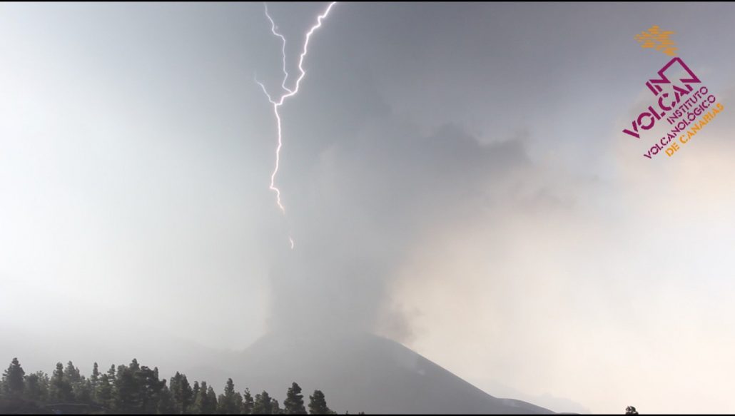
Scientists from INVOLCAN documented several volcanic lightnings seen in the eruption column.
Over the past days, these have become more frequent. This goes along with the observed increase in explosive behaviour at the vents – more material is being fragmented into ash (as opposed to liquid lava fountains) and the resulting particles are probably finer as well.
Such volcanic “thunderstorms” are often seen during explosive eruptions producing large quantities of ash, although the details are still poorly understood. In a simplified model, the lightnings are the result of electric charges accumulating in different parts of the eruption cloud, where friction between the ash grains rip of electric charges (electrons) from each other. The more quantity of ash emitted, the faster and more turbulent it is moving and the finer the ash grains, the more likely this process occurs.
Video of the explosive activity yesterday:
spacer

spacer

spacer
spacer
La Palma volcano eruption update: intense ash emissions, no end in sight despite decrease of quakes
09:56 AM | POR: T
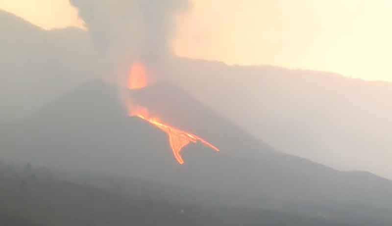
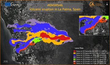
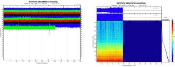
Eruptive activity remains elevated, dominated by strong ash emissions reaching up to 18,000 ft (5.5 km) altitude today, but fortunately drifting west over the Atlantic ocean and sparing the airport. Local sources reported loud explosions could be heard over night. The eruption has been becoming increasingly “ashy”, or explosive, at least when it comes to what can be seen at the vents:
At the active cone, the emission of incandescent, fluid lava by fountaining and lava flows is less intense compared to previous days, but volcanic tremor remains very high, suggesting that the effusion rate has not dropped. The most likely explanation is not that activity has decreased, but that most of the fluid lava erupted is diverted directly into a lava tube system and mostly remains hidden from view, until it emerges somewhere downslope to feed surface flows on top of older flows or create new active flow tongues along its margins.
In fact, active lava flows continued to advance at various fronts over the past 24 hours as well, most notably feeding the southern arm (red in the attached map), which was very close to the sea shore near Puerto Naos yesterday; it is unclear whether it has already created a second sea entry south of the existing one,but it looks as if has not.
For the local communities, it can be hoped that as much as possible of the lava goes into the ocean rather than continuing to destroy new land areas, but unfortunately, nothing can be done rather than to watch and wait.

Flight # 3D over the evolution of the lava flow, with data from
, from the 24th to yesterday the 29th at 08:08.
As of yesterday, the latest data published are 970.0 ha of land covered by lava flows (23.5 ha added in 24h), and 2,562 destroyed buildings (30 more during 24 hours).
Earthquakes on the other hand have decreased significantly, with less than 100 events of magnitudes between magnitudes 2.4-3.5 during the past 24 hours.
Deformation of the ground remains stable. Following yesterday’s deep magnitude 5 quake, no quakes larger than 3.5 have since occurred.
It is impossible to draw concise conclusions; however, the presence of strong tremor and the relative drop in quake activity could mean that the plumbing system is in a phase where magma is rising from its deeper sources to the surface encountering less obstacles at the moment. In other words, less quakes don’t mean at all that the eruption has slowed down.
spacer
Oct 31, 2021
Hello, I’m a Bushcraft Bear and share the latest information about the current volcanic eruption on the island of la palma in my videos. If you would like to support my YouTube channel, you are welcome to do so here:
spacer
Oct 31, 2021
spacer
Oct 31, 2021
spacer

spacer
10/30/21
THEY ARE NOT REPORTING OF THE EARTHQUAKES OVER 3.0. In fact they took the 4 and 5 Magnitude quakes off their search options. (10/31 update they have put the 4 and 5 options back up)
THIS IS FIRST VIDEO IS FROM YESTERDAY.
Oct 30, 2021
spacer
THIS IS WHAT IS AVAILABLE AT THE MULT VIEW LINK FOR LA PALMA TODAY. THEY DO NOT WANT US TO SEE ANYTHING!
 spacer
Spacer
 |
spacer

 |
Oct 30, 2021
spacer
spacer


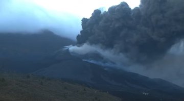
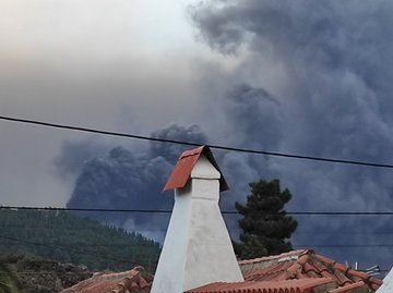
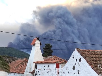
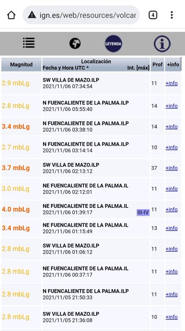


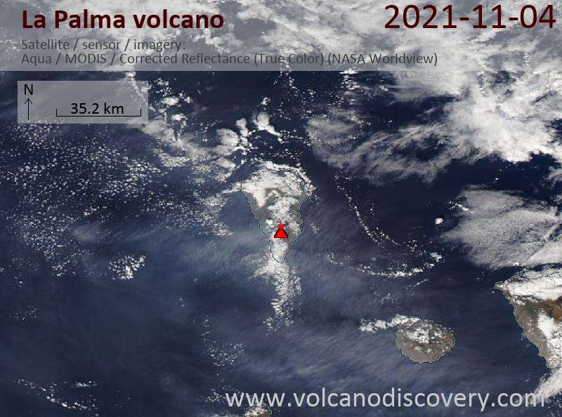


 World
World


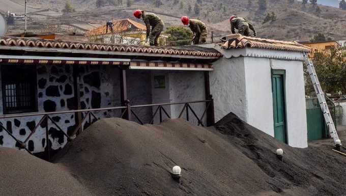


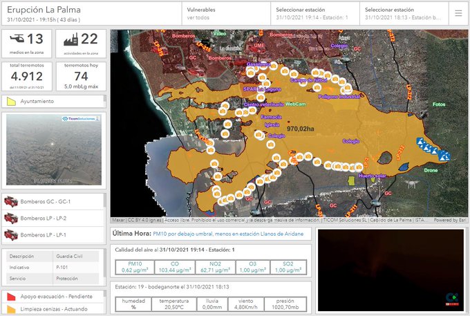


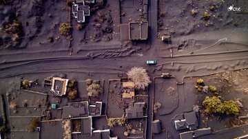

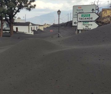

Comments are closed.